We have extensive experience of using all types of inputs sources to deliver enterprise grade custom annotation & labeling. Our unique combination of human annotators and AI-enabled tools is built to solve a wide range of industry use cases. From image labeling to the creation of high quality datasets for Machine Learning, we help gain actionable insights from high volumes of unstructured data so that our clients are able to drive their models on time and to budget.

Image

Video

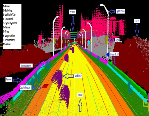
LiDAR

Text
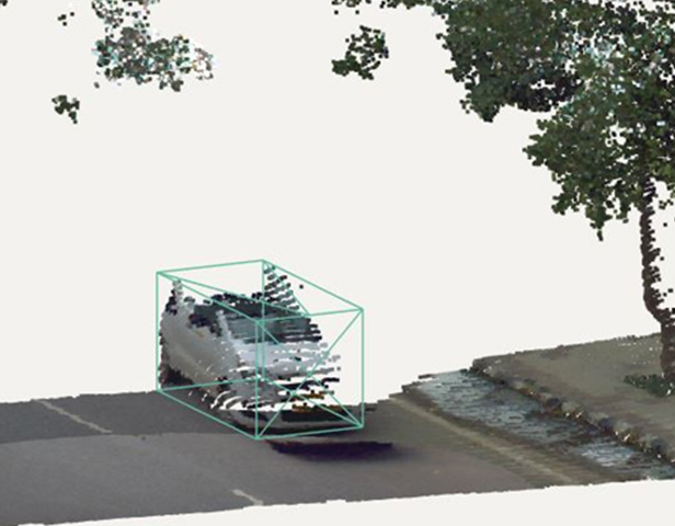
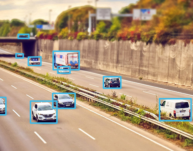
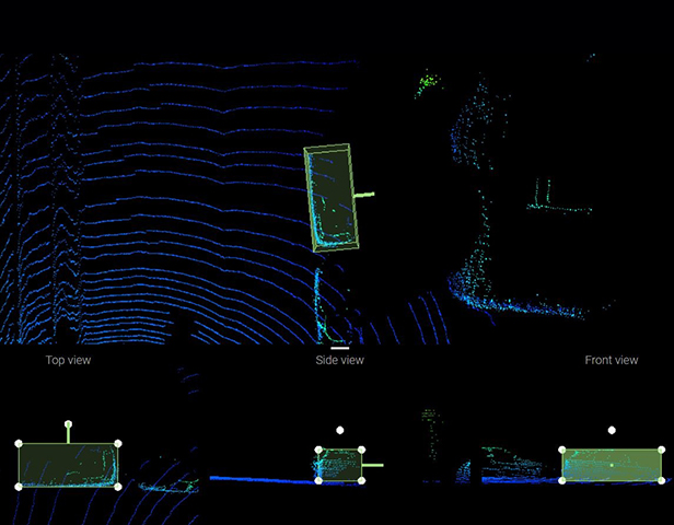
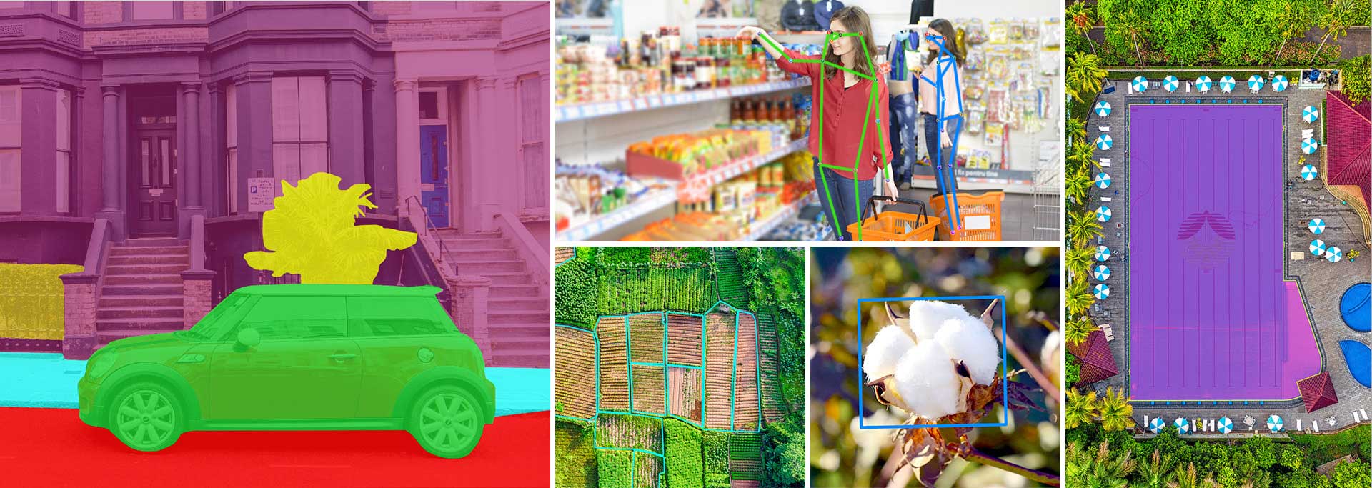
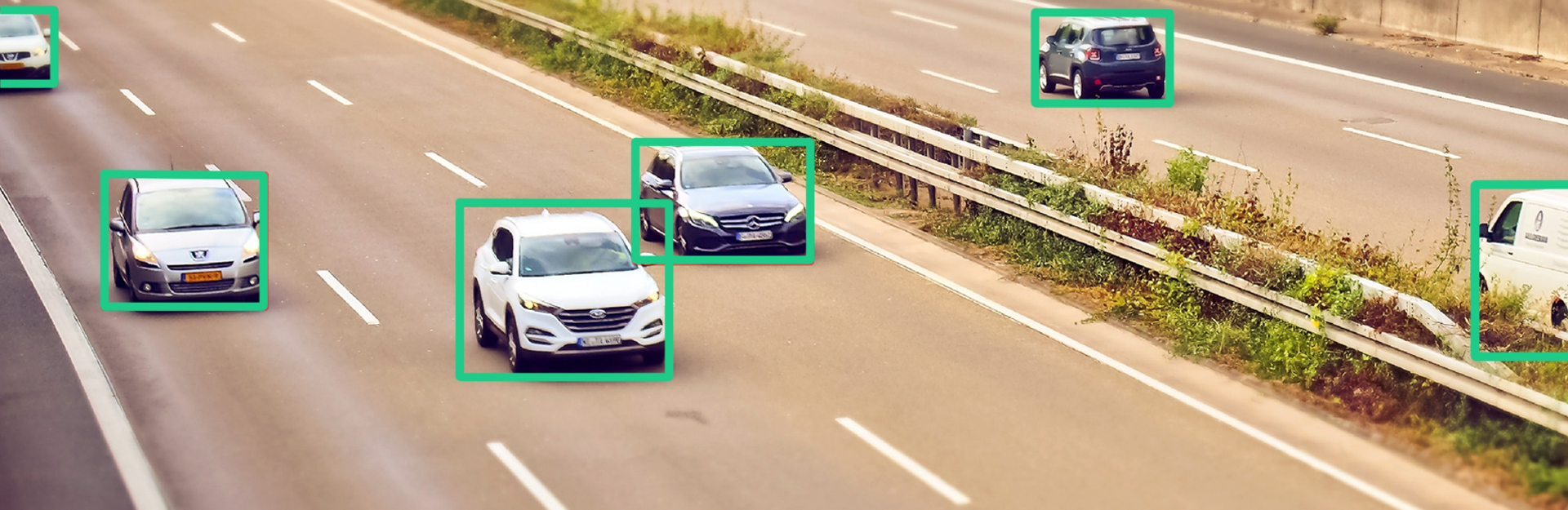
Bounding Box (2D/3D)
Annotating images or videos with bounding boxes around objects of choice. Widely used to train autonomous driving prediction models for lanes, pedestrians, cyclists, vehicles, etc., object detection for ecommerce, damage detection for insurance, drone and robot training.
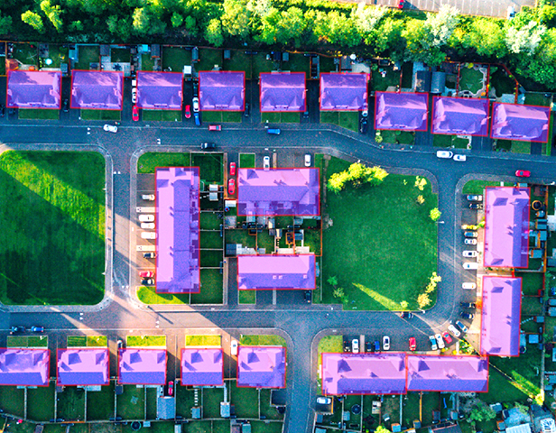
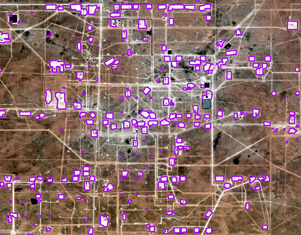
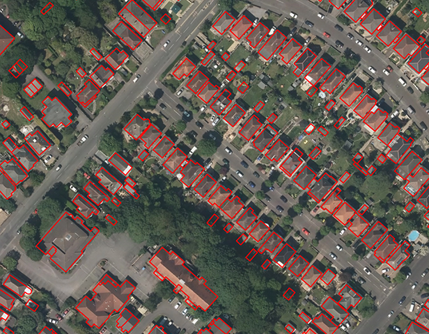
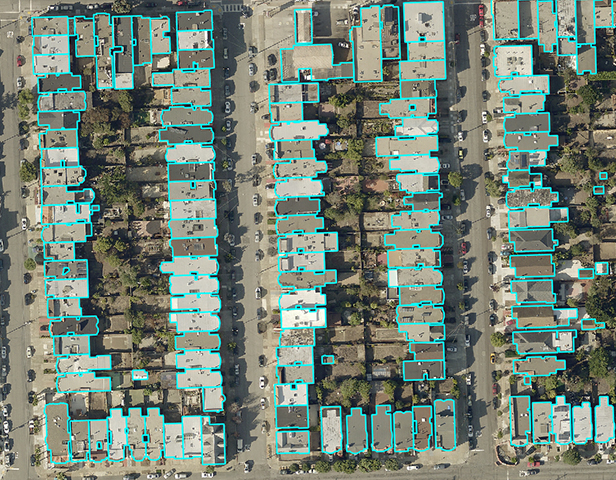
Polygons
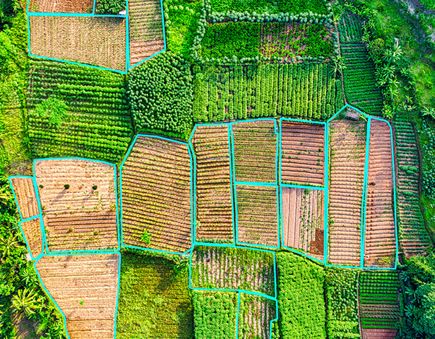
Drawing polygons by identifying the exact shape of the object in aerial and satellite imagery. Usually used to mark the shape of an irregular object which cannot be accurately captured by bounding boxes with precision. Polygons are useful for creating training data sets for AI and machine learning in multiple industries.

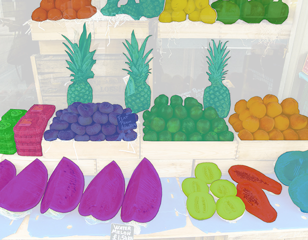
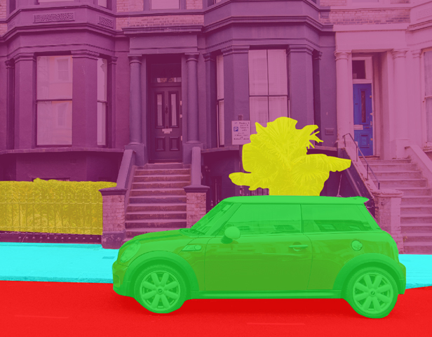
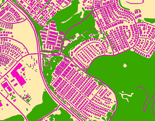
Semantic Segmentation
Semantic Segmentation is an aspect of image processing and computer vision process used to locate objects and boundaries defined in real world as two dimensional functions. Semantic segmentation links each pixel in an image to a class label. These labels could include a person, car, flower, piece of furniture, etc. on roads, in retail shops.
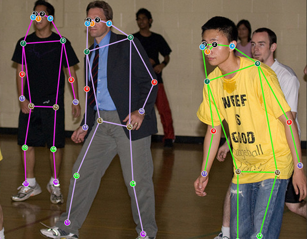
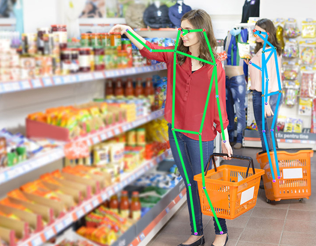
Key Point Annotation
Key point annotations are used to label facial/skeletal features, automotive parts etc. in an image. We label images using points to determine the shape of it. We provide key point annotation in human faces by marking facial features, joint positions, using single points for detection of emotions and facial recognition such as for retail, supermarkets and grocery stores.

Geo-Annotation
We create geographic models using remote sensing technology, such as satellite, aerial, and drone imagery to produce and curate training data for machine learning and computer vision models. Geo-annotation is useful for aerial view and drone imagery annotation, bounding box, semantic segmentation, etc.
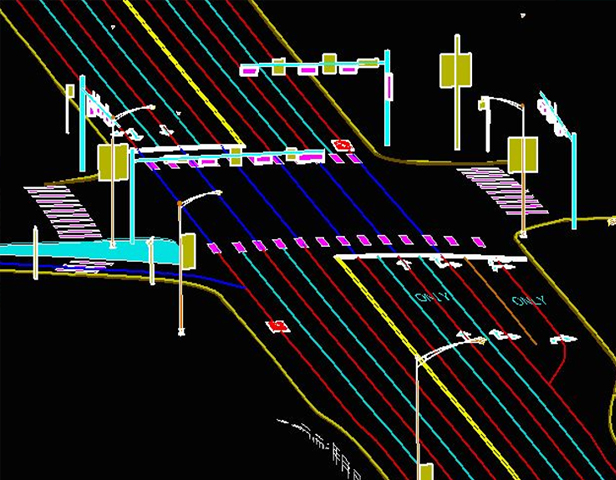
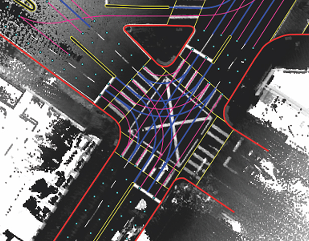
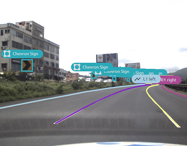
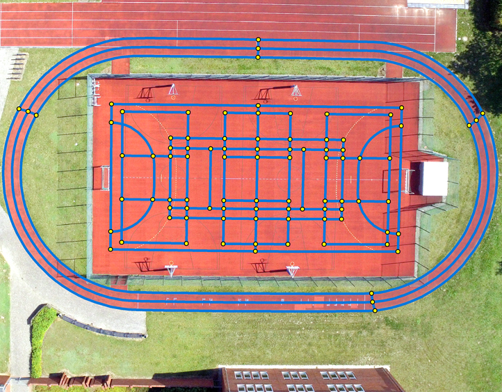
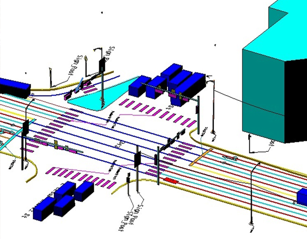
Polylines
Accurately define lane lines in drivable areas for vehicle perception models. Feature used for labeling GIS data like roads, lanes, highways, airstrips, rail road’s, coastal line, and annotating lines and circles of fields, etc.