The client, one of UK’s national mapping agencies, is one of the largest producers of maps. They are responsible for the official, definitive topographic survey and mapping of the region. With a mission to maintain the currency, accuracy, and information content of the client’s core databases, the client sought a long-term solution to keep their geospatial data up-to-date. The primary objective was to provide the client with a comprehensive geospatial data update service, ensuring the highest levels of accuracy and completeness.
The Challenge
The national mapping agency faced an ongoing challenge of keeping the geospatial databases up-to-date. This required continuous updates across diverse landscapes, from densely populated urban areas to expansive rural and moorland regions. The complexity was further amplified by the need to incorporate both real-world changes and data refinements, demanding a robust and adaptable solution. Maintaining consistent quality and meeting stringent deadlines were critical success factors.
The Solution
To tackle this large-scale geospatial update, RMSI created a team of experts with expertise in complex data updation, application development and workflow management. To meet the project’s demands, RMSI set up a process-driven framework, ensuring seamless execution across diverse land types—urban, rural, and moorland. The key elements of the solution included:
RMSI established a dedicated team and infrastructure to handle the project's volume and complexity over the four-year period.
Well-defined, specification-driven processes, along with comprehensive training and documentation, were developed to ensure consistent data updates across different land types (rural, moorland, and urban).
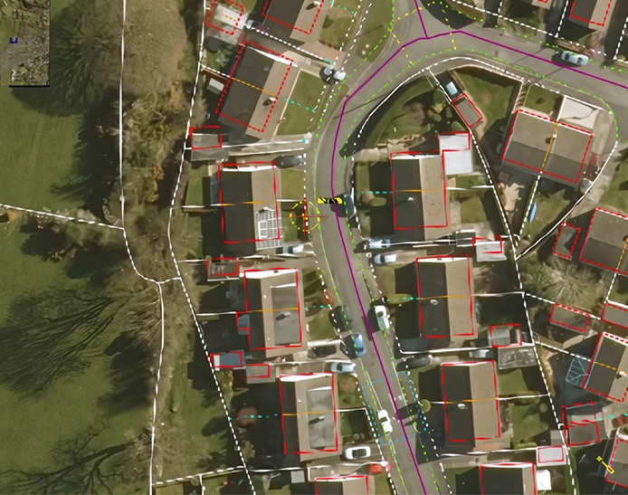
Ortho imagery was used for rural and moorland edits, while photogrammetric 3D visualisation was employed for urban area edits, all adhering to the client’s rule base.
Automated checks ensured the completeness, consistency, and quality of the updated data.
RMSI developed a custom WMS, incorporating project health review and a query management interface, to facilitate efficient project tracking and communication.
Previous
Next
The Impact
While updating national maps, RMSI empowered the client to navigate the evolving landscape of the region with confidence and achieve desired throughputs in a short turnaround time. By delivering timely and accurate geospatial data updates in a cost-effective manner, we adhered to the budget while ensuring year-on-year efficiency gains, translating into tangible cost savings. The project’s success is measured not only in the data points collected but also in the client’s enhanced ability to support informed decision-making across the nation. The scalability and consistency of RMSI’s solution empowered the client to meet their commitments seamlessly, reinforcing their position as a national mapping authority.