Shaping a Smart and
Sustainable World
Navigation & Mapping | Utilities | Sustainability | Telecom | Land & Infra
Innovative geospatial & engineering solutions for multiple sectors
Mapping partner for global Big Tech and Map data providers
RMSI Recognized as a National Best Employer Brand 2025
Nurturing an environment of diversity & inclusion
Accelerate The Development Of Your AI Models With Enterprise Grade Training Data
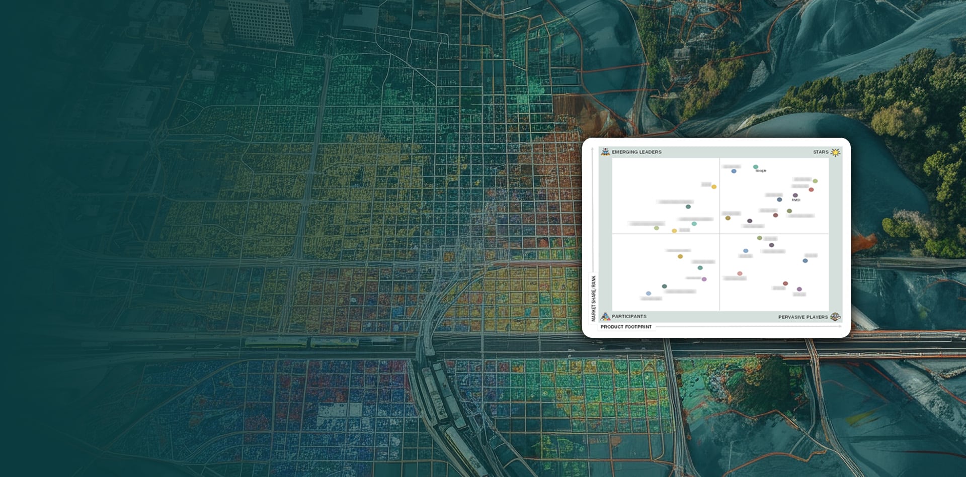
Geospatial Artha Business Leadership Awards 2024
Recognized as the
Geospatial Company of the Year
Leading the Way in GeoAI:
RMSI is a ‘Star Company’ in Geospatial Intelligence
Innovative Geospatial & Engineering Solutions for Multiple Sectors
Energy & Utilities | Telecommunications | Navigation | Corporate Sustainability | Public Sector
Mapping Partner for Global Big Tech and Map Data Provider
Accelerate The Development Of Your AI Models With Enterprise Grade Training Data
RMSI Recognised as a National Best Employer Brand 2025
Shaping a Smart and Sustainable World
RMSI delivers Geo AI, digital twins, and smart automation to utilities, telecom, sustainability, and public sector — turning complex spatial data into strategic enterprise advantage.
Years of Geospatial Expertise
0+
3 decades of geospatial expertise and continuous innovation
Countries Served
0+
Clients across diverse global markets
GLOBAL SUBSIDIARIES
0
Worldwide presence serving clients across continents
IT PROFESSIONALS
0k+
Talented team delivering world-class solutions
Top Employer
#0
Industry-leading company to work for
Where We Make an Impact
Energy & Utilities
Utilities are transforming for a smarter, more resilient future, achieving 30% gains in reliability, 52% lower compliance risks, and unmatched efficiency.
The telecom industry is driving rapid network growth and digital reinvention cutting churn by 30%, accelerating service rollout by up to 30%, and lifting satisfaction by 15+ NPS points...
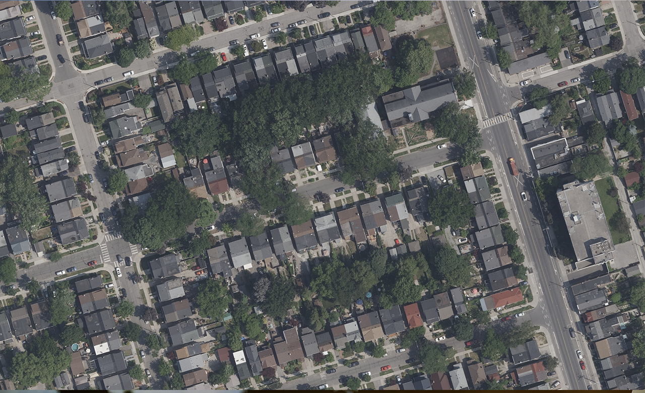
The navigation sector stands at the intersection of rapid innovation and operational scalability demanding faster rollouts, sharper data strategies, and resilient supply chains.
Sustainability is no longer just about reputation it’s about enterprise value and business continuity. Climate risks threaten trillions in global enterprise value, while strong ESG performers enjoy up to 15% lower capital costs.
RMSI manages the entire transformation journey – from data acquisition to AI-driven insights – so clients can focus on outcomes, not infrastructure.
Data
RMSI provides these services using disparate sources like paper maps, pre-existing digital data, field collected information, and multi temporal information across varied digital formats like jpegs, pdf’s and for use by technology agnostic systems ranging from proprietary to open source.
RMSI has proven experience and expertise in end-to-end enterprise software application development that includes the entire spectrum of integrated software services and business solutions. Our customized solutions range from desktop to large, scalable and secure web-enabled systems for enterprise and public portals. We have a reputation for either building customized solutions grounds up or taking over the maintenance and support of the client’s existing applications.
RMSI provides image processing services to create and update geographic datasets for a variety of end users. These range from land use planning, utility planning, urban and rural infrastructure planning using high resolution imagery to forest mapping, watershed management, natural resource mapping, and mineral mapping using low resolution imagery.
We help clients thrive in the digital age with advanced geospatial analytics, business process re-engineering, and cutting-edge technology. Our services streamline operations through automation, digital asset transformation, and data-driven insights.
We have extensive experience in developing quantitative models to assess potential losses from natural and man-made hazards. We offer both deterministic as well as probabilistic models based on catalogues of historical events, physical processes of hazards, local site conditions, exposures, building and social characteristics and damages in the past.
RMSI has over two decades of experience in offering enterprise-grade custom annotation & labelling services. We address your training data needs with automated tools, human annotators to reduce curation fallouts, and a powerful workflow driven AI enabled platform.
Stay ahead of industry trends with expert perspectives on geospatial technology, data management, and digital transformation. Our thought leaders share insights that help you navigate the evolving landscape of location intelligence and make informed decisions for your business.
Experience a workplace where innovation meets collaboration. At RMSI, we foster a vibrant culture that celebrates diversity, encourages creativity, and empowers every team member to reach their full potential. Our commitment to employee growth and work-life balance makes us an employer of choice.
Our values shape who we are, guide how we work, and define the impact we create.
Join Our Global Team
Ready to make an impact? RMSI is always looking for talented individuals who are passionate about technology and innovation. Whether you’re a seasoned professional or just starting your career, we offer exciting opportunities to grow, learn, and contribute to meaningful projects that shape the future of geospatial intelligence.
Explore current openings across our global offices and discover where your skills and ambitions align with our mission. Join a team that values excellence, celebrates diversity, and empowers you to achieve your full potential.