logo_RMSI
Global

90% Accuracy in Surge Height Prediction

Validated with 200+ Cyclone Events

High-Resolution Output: 1km x 1km

48-Hour Advanced Cyclone Forecasting

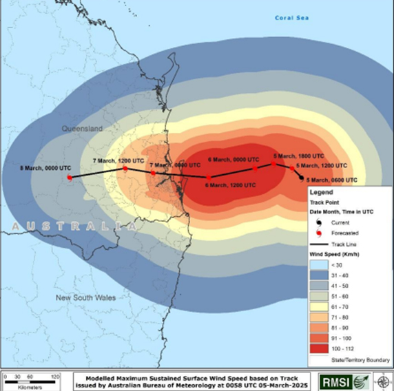
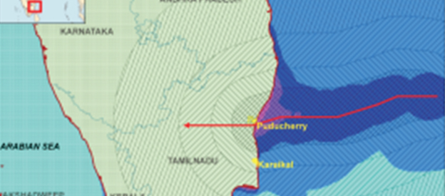
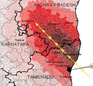
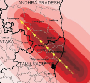
RMSI has developed an “India Hazard Cyclone Model” for the scientific computation of surge heights associated with tropical cyclonic storms to address the cyclone-related key issues in India. This model is capable of generating hazard maps up to 1km resolution for any cyclone, historical or incoming.

  • Dynamically simulates cyclone-induced hazards—wind fields, storm surge, and depth-averaged currents—using scientifically validated numerical models.
  • Enables real-time scenario-based forecasting to support early warning systems and disaster preparedness planning.
  • Delivers granular hazard insights at sub-district resolution, including habitat-level wind risk mapping via advanced GIS tools.
  • Integrates live meteorological data to update cyclone tracks continuously, enhancing forecast precision and response agility.
  • Designed to support catastrophe risk modeling and exposure assessment for insurers, reinsurers, and coastal infrastructure planners.

Key Industries

gas-distribution

gas Distribution

electric

electric

telecom

telecom

water

water

transportation

transportation

Let's Talk About Your Needs

En