RMSI offers Asset Lifecycle Intelligence through our ALDM solution. It enables utility in updating and maintaining the network and asset information in GIS and Asset Management systems. This helps utilities in achieving operational efficiencies and meeting safety compliance.
RMSI has built strong tools and accelerators for automating feature extraction, updating records and ensuring complete chain of custody ensuring safety of critical asset records
Our proprietary solution ConflateX™, assists in conflating network data with over 70% automation and 100% data integrity by aligning network assets to a more precise and accurate real-world system.
We offer services across our client’s asset data lifecycle management
Design drafting and engineering
As-built work order management
Data cleanup/consolidation & migration
Data maintenance – asset & landbase network
Quality improvement programs
Easement / RoW Mapping
Utilities invest billions annually in asset maintenance, grid hardening, and vegetation management. However, without robust data-driven strategies, much of this investment remains reactive, inefficient, and misaligned with actual asset risks—leading to longer outages and higher costs.
By leveraging advanced analytics and geospatial intelligence, utilities can reduce outage restoration times by 25–30% compared to industry peers while optimizing spend and improving grid resilience.
Operational Excellence is no longer achieved through more steel in the ground
— it is achieved through data mastery across the full asset lifecycle.
Our Product
LiDAR Managed Services
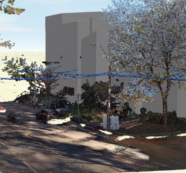
RMSI offers LiDAR Spatial Intelligence through high precision LiDAR managed services combining GIS, street-level imagery with AI and ML technologies. We automate data processing and visualization tasks to deliver analytical outputs in computer-aided design (CAD) and geographic information system (GIS) formats.
Asset data extraction for Transportation infrastructure and Utilities
Pole inventory and pole loading analysis
Vegetation risk management and analytics
LiDAR-based Conflation
Quality improvement programs 3D models and Digital twins
EPRI finds utilities that leverage LiDAR for vegetation management achieve 40–60% fewer clearance violations, cutting outage minutes and wildfire risks.
Without trusted, harmonized, and expertly managed data pipelines, ALDM becomes just another IT system and LiDAR becomes just another dataset. The true value emerges only when utilities have the expertise to integrate, clean, analyze, and operationalize data across planning, operations, and compliance workflows.
Without expert data strategies, ALDM and LiDAR are just tools.
With them, they are the foundation of operational excellence.
Our Product
UN Implementation
We offer Network Modernization & Modeling through RMSI’s integrated Utility Network Digital Transformation (UNDT™) Solution which is an end-to-end migration toolkit with customized in-built automated scripts and processes, thereby ensuring zero data and integrity losses through
Data Readiness Assessment
Conflation & Realignment
UN Migration
Business Integrations
RMSI brings in a pre-configured solution and toolsets to limit the decisions that customers need to make which reduces the time and effort to transition to the UN.
ArcGIS Utility Network represents a major advancement in the GIS utility sector. Transitioning to this system is a systematic journey, including the reconfiguration of architecture, asset classification, and integration with existing business processes.
Specifically for the Small Utility customers, RMSI offers a simplified and pre-configured asset package that provides efficient data assessment, migration and implementation experience.
Utilities are being pushed to modernize networks under immense pressure—aging infrastructure, surging DER and EV adoption, and climate volatility. UN Migration (network modeling & modernization offerings) promises agility and visibility, but on its own it is not enough.
The difference between transformation and stagnation isn’t the migration itself—it’s the expertise in how data is harmonized, modeled, and applied.
Utilities that migrate without expert data governance risk perpetuating the same data silos, inconsistencies, and compliance gaps they set out to solve. Innovation only happens when data strategies ensure accuracy, interoperability, and predictive intelligence across the modernized network.
Digital Twin
RMSI transforms how utilities manage their network assets by providing immersive, interactive 3D models. Utilizing high-precision LiDAR, GIS, street-level imagery, AI, and ML, our experts create high-fidelity digital twins that accurately mirror the geometry and properties of real-world assets.
These digital models allow utilities to visualize their networks in 3D, identify hazards, optimize maintenance, and effectively train staff. Our innovative AR/VR solutions overlay digital information onto the real world, enhancing situational awareness and safety while facilitating collaboration.
By the power of 3D modeling, GIS, and AR/VR technologies, RMSI empowers utilities to gain a deeper understanding of their networks, optimize operations and deliver exceptional service to their customers.
Without it, migration is just moving problems from one system to another.
Our Product
Vegetation Management
RMSI helps with utility Environmental Risk Mitigation through its Vegetation Management Solution by integrating GIS, AI/ML, and high-resolution aerial imagery to automate the processes of vegetation identification, extraction, and visualization.
This advanced approach delivers detailed datasets of vegetation along utility corridors, presented through comprehensive 2D and 3D models. Each dataset includes precise GPS coordinates (XYZ) for every identified feature, enabling tailored analyses for vegetation clearance and encroachment assessments, tree fall risk evaluations, and growth rate simulations.
RMSI also offers processing of high precision LiDAR managed services combining GIS, street-level imagery with AI and ML technologies. Key services include:
Asset data extraction for Transportation infrastructure and Utilities
Pole inventory and pole loading analysis
Vegetation risk management and analytics
LiDAR-based Conflation
Quality improvement programs3D models and Digital twins
Vegetation management doesn’t deliver compliance by itself
—data expertise does. Without expert data, utilities cut trees but not risk.
Our Product
Easement Mapping
RMSI helps with Land Rights & Regulatory Compliance through our Easement Mapping solution.
It helps to identify, manage, and understand legal rights of accessing or retrieving information pertaining to right of way or property, which is crucial for property transactions, construction, and infrastructure projects.
Specifically for the Utility operators, accessing right of way or easements is necessary to manage utility infrastructure assets for various planning and operation functions. The majority of property description information pertaining to such easements, some dating back to 1890s, exist as lines or handwritten annotations in the physical Public Land Survey (PLS) grids. This poses a challenge for interpretation of easement information and the manual conversion methods are time consuming and incur costs.
RMSI has developed a proprietary solution based on AI/ML and Natural Language Processing (NLP) tools that automatically detect and map legal descriptions, bearings, and distances. These AI/ML based techniques train models, validate and interpret the lines and text to convert raster easements into digital information.
Extraction of Text, Features, and classification using AI/ML & NLP based models
Automatically detect and map legal descriptions, bearings, and distances
Hyperlinking and easy retrieval of documents
Reduces digitization efforts by 80%
>70% accuracy based on competing ML models, with 40-50% overall savings in costs
Amongst the very few in the market to offer this solution
For utilities, land rights and easement compliance have become critical points of regulatory risk and operational exposure. Aging records, fragmented data, and unclear easements often delay projects, stall regulatory approvals, and expose utilities to costly legal disputes.
Utilities don’t lose time and money because they lack easements—
they lose it because they lack trusted easement data.
Our Product
Let's Talk
Utilities that act today will lead tomorrow. From operational excellence to regulatory agility, from digital innovation to sustainability, the path forward is clear: embrace transformation, or risk being left behind.
RMSI empowers utilities to evolve into the ‘Utility of Tomorrow’ by offering digitally-enabled, adaptive and sustainable solutions transforming operations and service offerings by embracing advanced technology, data analytics, and customer-centric practices, becoming highly adaptable and responsive to ever changing needs of the industry.
Contact RMSI today to discover how our comprehensive solutions can help your utility achieve operational excellence, regulatory compliance, innovation, and sustainability in an increasingly complex landscape.