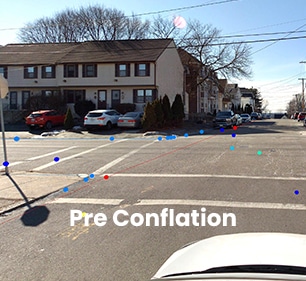
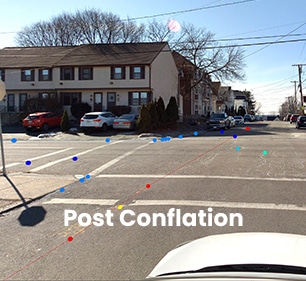
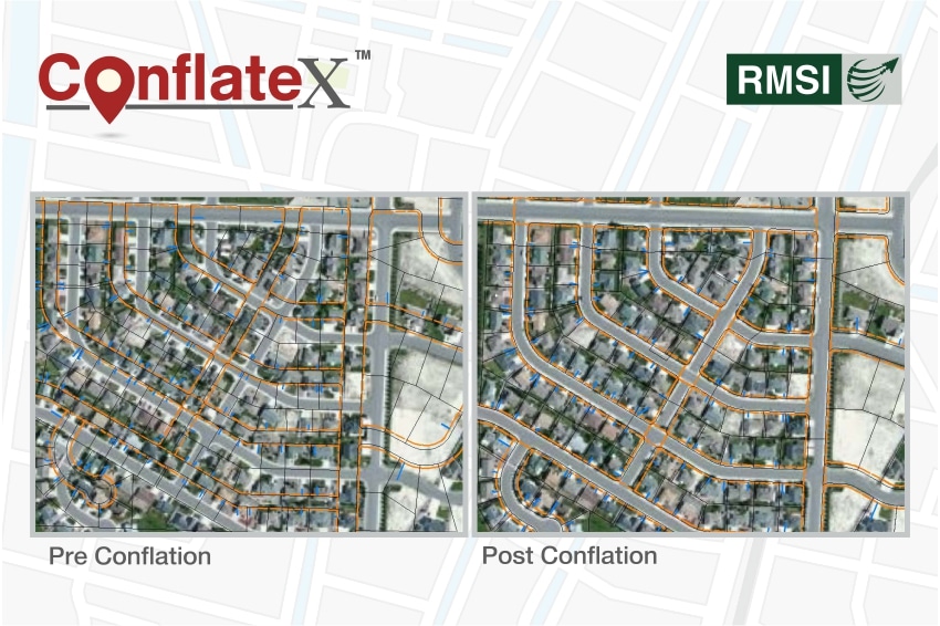
Conflates network to target landbase, and/or aerial imagery
Maintains network data integrity to support business workflows
Business rules driven, highly customizable solution
Zero data loss/
integrity
& zero system
downtime
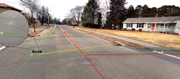
ConflateX™ is a scalable data conflation solution that addresses the key business challenges of improving spatial accuracy and data integrity of network assets by aligning them to a more precise and accurate real-world system.
The solution helps utilities in handling their increasing need to deploy integrated and more spatially accurate network data. This helps them in managing reliable asset networks efficiently while meeting stringent safety and regulatory requirements.
ConflateX™ has industry specific workflows that can be further customized, utilizing both automated and interactive conflation techniques to achieve operational objectives.
Solution Highlights
Integrated workflows to handle large volumes of datasets
Implementation over Esri ArcMap & ArcGIS Pro supporting all industry formats
Conflates network to target landbase, LiDAAR and aerial imagery
Business rules driven, highly customizable solution
Programmatically-driven links to ensure higher precision & relative accuracy
Business Benefits
Minimal Freeze time: Phased seamless deliverables, ensuring minimum downtime impacts to business
Assured Zero data losses: Rule based approach, resulting in zero data, geometry and attribute losses
Efficient handling of heterogenous data shifts
Analyzes and reports distorted patterns, thereby facilitating best transformation algorithm for optimal results
Elimination of manual errors – Highly automated process driven solution, ensuring cost optimization and minimal manual intervention
Play Video
Key Industries
Gas Distribution
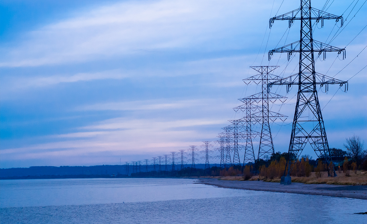
Utilities
telecom
Water & Sewer
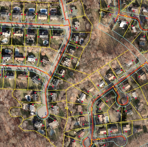
Landbase
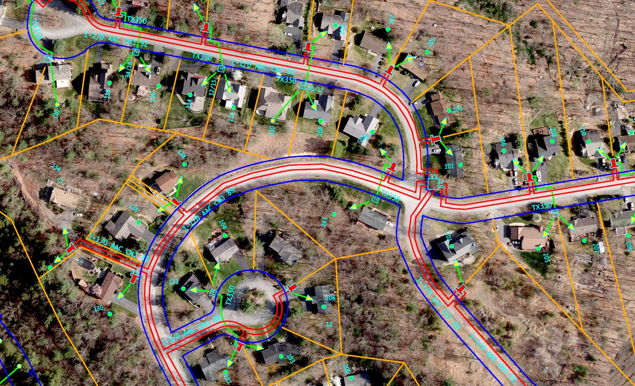
Conflated 10,400 miles
of gas distribution network to positionally accurate landbase, and to aerial imagery where landbase was not available