WIRELESS TELECOMMUNICATIONS
Largest repository of geodata products of most recent vintage
In today’s competitive landscape, the wireless telecom industry faces multiple challenges including optimizing infrastructure costs, improving customer experience, and coping with the rapid transition of technology. We at RMSI, provide geo-data solutions that help the industry address these key challenges.
RMSI is the world’s leading supplier of geo-data for fixed wireless (WLL, LMDS) and mobile wireless (GSM, CDMA, TDMA, UMTS and WiMAX) networks. Our solutions help clients in wireless network planning, design and performance optimization. Our solutions include DEM/DTM, Land Use/Clutter, Vector/Linear databases, 3-D building heights and off-the-shelf geo-data products, at varying levels of details, resolution and accuracy.
With two decades of experience, our mapping solutions are used by wireless and cellular operators, equipment suppliers, and network planning consultants, who incorporate RMSI’s databases for multiple wireless applications, ranging from preliminary regional network planning and coverage analysis to micro-cell design, line-of-sight analysis, network expansion and site acquisition.
RMSI owns one of the largest international inventories of off-the-shelf geodata products in the industry including 5,000 cities and 150 countries. RMSI has also established a leadership position in the 3D data market for mobile wireless technologies. For customized software requirements, RMSI has varied experience of developing simple desktop viewer applications to large, scalable and secure web-enabled systems for enterprise and public portals.
3D Data
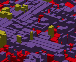
Resolution: 1-5 meters
Coverage: Client specified high dense urban sprawls, CBD areas
Layers: Digital Terrain Model (DTM), Digital Surface Model (DSM), Digital Building Height Model (DHM), Vegetation Model, 2D Linear Feature, Clutter, Ortho Image
2.5D Data
Resolution: 5 meters
Coverage: Client specified urban sprawls
Layers: Digital Terrain Model (DTM), Vectors, Average Height Based Clutter (Land Use), Orthoimage
Land Parcel based data creation approach
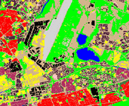
City Data
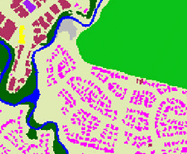
Resolution: 5-20 meters
Coverage: Client specified dense urban sprawls
Layers: Digital Terrain Model (DTM), Vectors, Clutter (Land Use), Orthoimage
Parcel (encompassed between road/street network) based data creation approach
Regional Data
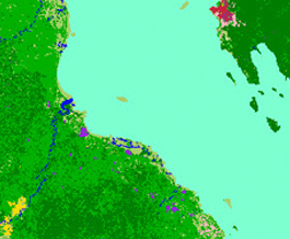
Resolution: 30-100 meters
Coverage: Complete countries or client specified regions
Layers: Digital Terrain Model (DTM), Clutter (Land Use), Vector (Linear) and Text
