SUCCESS STORIES
NAVIGATION & MAPPING
Navigation
One of the global leaders in navigation industry dealing in Maps (Standard Definition Maps, Advanced Driver Assistant System, and High Definition Maps), Traffic and Travel Information (Real-time Traffic and Warnings, Speed Camera locations and Profiles), Navigation for Automotive Vehicles (Navigation Engine & User Interface), Automated Driving and Road Analytics.
Business Case: With two decades of mapping expertise and synthesis in navigation domain, RMSI has worked with leading mapping and navigation companies in the world. The client was looking for a leading map data service provider. Our proven work history along with the required expertise and industry know-how, helped us win this client in 2015 to be their partner.
Solution
RMSI, with its 400+ skilled resource team is providing navigation data update and maintenance services to the client from last six years. We are serving the client’s map data for multiple geographies such as North America, Africa, Europe, Latin America, Oceania, Russia, South Asia and Middle East. The data development covers the following parameters:
- Restriction: DTFR (Direction of Traffic flow restriction) (any type of restriction), Manoeuvre, General Restriction, Minor Geometry changes
- Street Names: Update the street name using available country wise source material
- EV POI: Integrate Electric Charging POI locations using survey data and photographs
- Logistics: Update navigation data for Heavy vehicles routes where information such as maximum weight and height for a road network is crucial
- Geometry: Geometry creation and basic attribution using the available sources
Methodology: RMSI is providing navigation data update and maintenance services to the client using their proprietary applications. Global GIS software and environments such as ArcGIS, QGIS, AutoCAD, Oracle Spatial, Photoshop, FME workbench, Python scripting also being used for creation of custom product development.
Client Benefit
RMSI’s cost effective and qualitative services are enabling client to meet their business objectives, SLA requirements towards their customers and maintaining Key Performance Indicators (KPI) as well. RMSI is also value adding to the client through process improvement proposals for continual improvement in their day to day operations helping client improve their overall business performance along with navigation map data updation and maintenance.
 Background
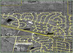
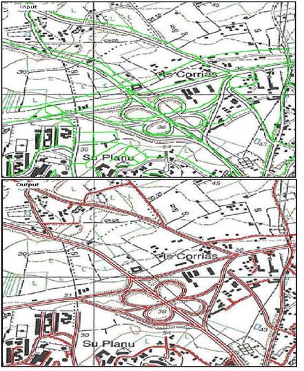
A Netherland based company and one of the few companies in the world supplying digital map data for GPS-based applications. To produce high quality premium navigation data set of road network covering North America. The scope of the project is to update following street & polygon geometry and attribution according to the AND Specifications and Work Instructions:
- Double digitizing & accurization of roads
- Attribution Lane information
- Attribution Floor codes
- Accurization & digitization of slip roads
- New roads & Connections
- Accurization & digitization of lay-by’s
Solution
RMSI studied the input data and performed all above mentioned tasks as per client’s specifications. To ensure high accuracy data RMSI developed many tools to ensure topologically cleaned, seamless and standardized GIS data as per project scope.
Client Benefit
- The client received a topologically cleaned, seamless and standardized GIS dataset.
- Delivered data was passed from all validations and could be directly inducted into the next process.
The client is a leading US digital street map database company, providing location-based applications, including in-car navigation, Internet services, wireless services, Automated Vehicle Location (AVL) services, and call-center services.
The client identified an opportunity to build its market share by entering the growing car navigation systems and location-based services (LBS) markets. To compete effectively, the client needed to:
- Significantly enhance the positional accuracy and attributes of its US vector database offering
- Dramatically increase its human resource capacity to handle the huge volumes of data
- Achieve high levels of process efficiency to complete the project within its budget and within a limited timeframe
Solution
Developing the solution involved:
- Quick recruitment and training of the project team, growing from 40 members to 250 members at the project peak
- Design of a rigorous process, consisting of nearly 100 predefined sequential steps, to enable effective process flows
- Development of several smart process automation applications, including a Work Allocation System (WAS) and a Workflow Management System (WMS) to generate manageable work units and closely manage the project, and algorithmic Quality Assurance (QA) programs to enable rigorous checking and deliver consistent output quality
Client Benefit
- Timely availability of updated, consistent quality datasets, enhancing the client’s capacity and process efficiency
- The client was able to position itself as a premier player in the larger North America LBS market
- Full visibility of project progress for both the client and RMSI teams thanks to RMSI’s WMS
- Using RMSI’s skilled manpower enabled the client to avoid making significant internal investments in high cost resource
- High levels of operational transparency, building a strong base on which to develop the client relationship
- Faster, more consistent data processing, and quality and pre-shipment checking, due to automated applications and algorithmic QA checks
- Considerable efficiency improvements due to integrated processes
Annotation & Labeling
 Client
The client is an expert in future mobility by providing enhanced solutions for latest technologies in ADAS and Autonomous Driving. They work for the development of new systems in the field of vehicle electronics as well as the validation of sensor-based driver assistance and safety systems.
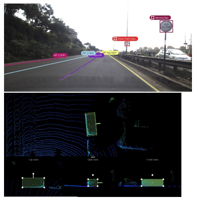
Business Case: The client was looking for a partner to provide complex annotation and labeling solutions including 2D annotations (line, point and polygon annotations), 3D LiDAR annotations (3D bounding box, semantic segmentation) and labelling for various static features such as road markings, traffic signs etc. as well as dynamic navigations features (vehicles, vulnerable vehicles, pedestrians, animals etc.) from vehicle mounted camera and LiDAR sensors. RMSI captured the feature classes with attributes in the client’s desired format and transferred them along with the metadata of input camera photos.
Solution & Methodology
With its sensor fusion expertise, RMSI provided the client, training data while maintaining accuracy and scale. Our experts captured and shared the feature classes with attributes along with metadata of input camera pictures. Our expertise in sensor fusion technology and flexibility of scale helped the client meet its end objectives.
We annotated the objects highlighted above in the form of feature classes using 2D and 3D annotation expertise:
- Input preparation in LiDAR format
- Uploading of LiDAR data in annotation application
- Creation of different type of classes as per the specification
RMSI has delivered the final output in JSON format to the client.
Client Benefit
The client is using this high quality labelled data to create their training data sets for AI algorithms to be used in autonomous driving. This will help them better understand the surroundings and in path planning. This data is also used for human perceptual and decision-making processes using deep learning and controls actions in driver control systems, such as steering and brakes.
Mapping
An Australian company, expert in spatial intelligence and risk mapping, is helping the government of Australia to identify the environmental risks in Australia.
The client is using latest geographical information systems (GIS) and database packages to turn data into meaningful information. They also hold experience in significant growth in environmental risk reporting services.
Business Need:
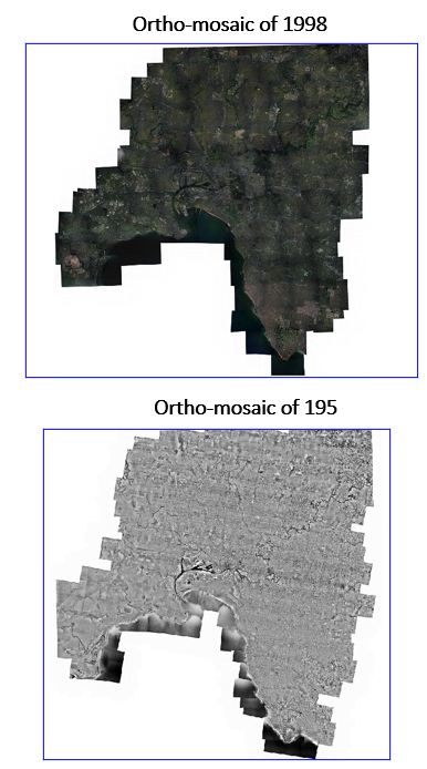
The client wanted to partner with a leading GIS expert for Ortho-rectification of historical aerial photographs, i.e. to Ortho-rectify, stitch and tile the seamless data of Melbourne core and Hobsons Bay in Australia. The accuracy requirement was as close as 1-2 metres with 4400 imageries (approx.) ranging from 1931 – 1998.
Solution & Methodology
RMSI carried out the ortho-rectification of historic aerial imageries across 1931 to 1998. Application Master Software was used to perform the ortho-rectification of historical imageries. Match AT was used for Aero-triangulation of imageries. DTM Master, Ortho Master and ortho – vista were utilized for DEM editing and ortho-rectified image generation. Reference data, NSW Imagery services/World Imagery for ortho rectification was provided by ESRI Arc GIS.
After seamless stitching, tiling was performed using Global Mapper Application in ECW format. RMSI provided the following solutions to the client.
- Ortho rectify the individual images using the Aerial triangulated result and DEM as per the defined GSD. Verify the geometric accuracy of the ortho using available reference data.
- Generate seam line/cutline using the ortho generation software.
- Edit the seam lines to make sure the seam line do not cross/cut important cultural features. Select the seam line along the boundaries such as rivers, streams, roads etc.
- Perform Mosaicing and automatic global tone balancing. Set up feathering distance to a small value in Urban Area and a large value in open area.
- Review the tone balance in the mosaic and extract tiles as per defined dimension.
Client Benefit
The final product was required to provide comprehensive reports that helped the client identify environmental risks in a timely and effective manner. The client has utilized this unique database of historical business activities, maps and aerial photos has been utilized to uncover potentially contaminated land.
UTILITIES
Utility GIS Data Solutions
 Background
An electric and gas utility providing energy to 745,000 people in six counties in New York and Northern New Jersey
Solution
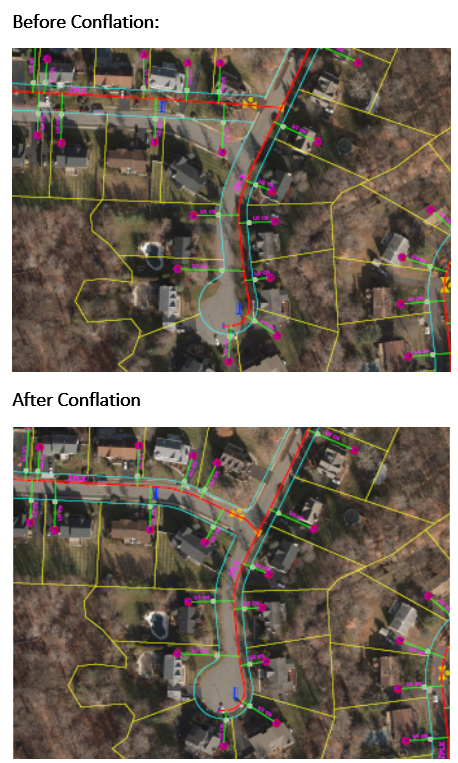
- RMSI utilized their proprietary ConflateX™ solution to manage the client’s spatial accuracy requirement
- The solution uses triangulation algorithm to get localized control between source and target landbase and utility network to achieve more than 60% auto conflation results
- Automatically conflates devices, fittings and annotation (100%)
Client Benefit
- Reduction of cost, timelines and penalties
- Utilization of smart devices by field crews to locate and progressively record accurate information against real world network positions
- Improved visualization of network and network defects found using high accuracy inspection techniques, (LiDAR, Point Cloud, High Resolution Imagery)
- Automated quality checks to ensure data integrity and connectivity
- Zero GIS down time, during conflation
Utility Network Digital Transformation (UNDT)
 Background
Client is a leading electric company in North America having over 9,800 miles of electric infrastructure serving more than 221,000 meters
Solution
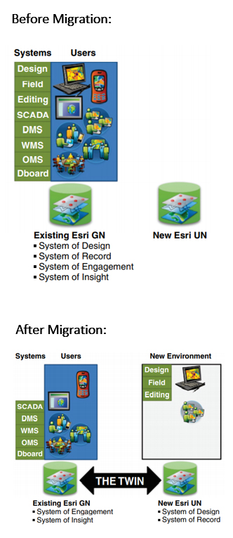
- Data Model Mapping between source Geometric Data Model and Target Utility Network Data Model
- Preparation of Data Model Readiness Assessment Report
- Necessary Input Data remediation of Pilot data before pilot migration
- Migration of Electric Distribution Utility Network data from source Geometric Data model to Target Utility Network data model
- Demonstration of UN to GN Synchronization module (Twin)
Client Benefit
- Compatible to work on both Esri / ArcFM data sets with set of tools
- Auto Data readiness and gap assessments report
- Business rules driven customization and spatial ETL scripts for migration.
- Handling multiple versions along with default version migration
- Ability to manage delta updates
- Auto Data Migration processes saving migration times
- Bi-directional synchronization that keeps the Geometric Network and Utility Network instances in sync
Utility GIS Digital Solutions
A leading Telecom provider offering high-speed data networking services
Solution
- RMSI experts conducted a detailed study of the client’s current NE data model & environment along with their existing workflows and reporting formats used by HOT
- RMSI experts created a fully operational production/disaster/staging instance for Schneider Fiber Manager
- Mapped over 4,000 business attributes from NE to Fiber Manager
- Developed Fiber Manager Schema to meet HOT requirements
- System software / hardware configuration requirements implemented
- Facilitated user acceptance testing, change management and warranty
Client Benefit
- Improved mean-time-to-restore (MTTR) for Cable Cuts
- Quick info to Customers about services outages
- Analysis of current service capabilities and support for revenue growth strategies
- Improved productivity and streamlined workflow
 Background
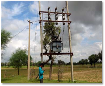
With an objective to reduce the AT&C losses, the Government of India had initiated a Restructured Accelerated Power Development and Reforms Programme (R-APDRP) for establishment of reliable and automated systems for sustained collection of accurate base line data, and the adoption of Information Technology for energy accounting.
As part of this program, a consortium led by HCL Infosystems (acting as the system integrator) won the bid for supply, installation, integration, testing, and commissioning and facility management service covering software, hardware, field survey and networking for the state of Rajasthan in India. Within the consortium, RMSI was responsible for developing a customized GIS enterprise application, base map creation, asset survey, and consumer indexing
Solution
Key project activities included:
• Quick recruitment and training of the project team, that grew to about 3,000 members at project peak
• Basemap creation for the entire project area of 3,34,000 sq.Kms using high resolution satellite data
• Electrical distribution network map creation for about 5,16,000 CKT Kms. using state of the art DGPS survey and mobile video mapping technology
• Consumer survey and data collection for 8.5 million consumers using GPS based hand held devises
• Development of a web based GIS application on ArcFM platform and integrating it with other enterprise systems
To ensure operational excellence, reduce costs and improve productivity RMSI:
• Programmed the hand held devices, being used for field data collection and asset mapping, at a firmware level to make it geographically and operationally secure
• Developed an application on AutoCAD whereby all the trace functionalities of ArcFM have been reengineered. This has led to a substantial reduction in the need for ArcFM licenses
 Background
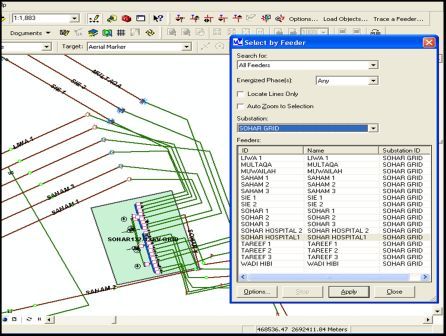
A major electric distribution company in Oman commissioned RMSI to prepare an asset inventory and map 33 and 11 KV electrical networks in Oman, and create ArcFM database for 33 kV electrical networks
Solution: The project was sequentially divided into the following three distinct stages:
• Survey and Data Collection – A team of surveyors and electrical engineers collected location specific and electrical attribute data from field and substations using DGPS, total stations, and cable locators
• CAD Data Processing – The survey data was processed, cleaned and attributes attached in AutoCAD using customized tools.
• Data Migration in ArcFM – AutoCAD data was migrated into ArcFM, which was followed by electric network tracing. Each completed region was delivered to the client as an ArcFM geo-database.
Client Benefit
The team achieved a 30 cm positional accuracy for all electrical assets, thereby resulting in better planning and pinpointing correct locations of all OH/UF and feeder assets. Moreover linking the ArcFM application with all other business applications enabled creating a true enterprise system
Background
A major electricity and gas company in Germany commissioned RMSI to digitize 25,000 Kilometers of its low voltage and medium voltage electrical network lines for the Ost-Bayern (East Bavaria) region in Germany in Intergraph’s G-Technology.
All of the client’s customer service centers were to be captured. Also, the inventory data (features) from the different raster files were to be converted into GIS features, with all their network connectivity and electrical topologies in place.
Solution
Key project activities included:
• Capturing street light, fiber network, and low & medium voltage data from raster files and update attributes accordingly
• Creating detailed drawings of stations, distribution boxes and street light boxes from multiple input sources such as RGR data (AutoCAD migration), station, distribution box, and switching unit detail sheets.
• Establishing graphical and logical connectivity between electrical and network features such as power supply directions, tracings, and parent-child relationship for features, amongst others.
RMSI also implemented an in-house developed Workflow Management System (WMS) for better work scheduling, tracking, and, management. Furthermore, automated and manual quality checks were implemented at every stage of project execution to ensure quality.
Client Benefit
The project helped to consolidate all data into a centralized database system. Also, Geo-enabling the electrical network lines helped the client in planning, analysis, maintenance and record management.
 Background
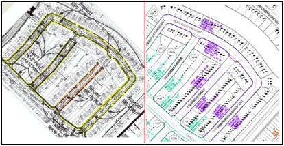
A leader in energy transportation and distribution in North America, the client wanted to support its planners by providing engineering drafting services as per municipal regulations for permit approvals. The client also wanted to maintain its gas network as per AS- built drawings.
Solution
RMSI is providing integrated services that support the overall drafting and geospatial functions of the client. These include engineering drafting services, network & landbase maintenance, and enterprise GIS migration. Key project activities included:
• Implementation of a web based project management system that serves as a real-time dashboard and project monitoring
• A centralized GIS repository providing necessary information to all business applications for interdepartmental decisions
• In addition to engineering drawings and updated GIS, RMSI is also providing integrated data flows to permitting, compliance, procurement, inventory control, and CRM
Client Benefit
RMSI’s unique managed services delivery model resulted in optimum utilization of client’s infrastructure, significant savings on capital investment, and guaranteed year on year efficiency gains. The client achieved over 99.8% achievement of turnaround time SLA’s and 50% cost savings due to off-shoring.
 Background
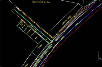
A Government of India undertaking with a mission to provide eco-friendly fuels and related services, the client wanted to create a detailed landbase and undertake demand surveys to extend its City Gas Distribution (CGD) and Compressed Natural Gas (CNG) networks in the industrial and commercial units of Vijayawada city in Andhra Pradesh, India.
Solution
RMSI used high resolution ortho-rectified QuickBird imagery (1m resolution) to capture landbase of the entire project area. These were then validated through field surveys.
Key project activities included:
• Quick Bird Imagery procurement and processing
• Field survey and collection of control points (DGPS) for geo-referencing input imagery
• Delineating charge areas of CGD network for operational planning
• Capturing information of all landbase objects (as per clients data model) and building footprints
• Undertaking detailed demand survey to assess the willingness of installing piped gas network
Client Benefit
The client received a detailed landbase with precise location of all CGD assets and important landmarks. This helped in better planning and maintenance of the distribution network.
Background
A leading energy delivery company that provides electric transmission & distribution and natural gas distribution, covering more than 5 million customers in North America.The client required near real-time availability of landbase and facility network data to be maintained as per AS-built information, ensuring data integrity across the enterprise.
Solution
RMSI performed GIS edits and updates, supporting the operational requirements in a custom designed interface based on hosted Enterprise GIS
Key project activities included:
• Creation and update of property and easement lines, street centerlines, point features and building polygons in accordance with real-world changes utilizing third party data sources and field note scans.
• Work order posting for facility networks
• Proper dimensioning and annotations with specific business rules for modifying gas mains
• Quality checks with valence tools to ensure features are positioned correctly with respect to locations
• Posting updated landbase data to Enterprise GIS using inbuilt functionality & conversion tools
Client Benefit
Near real time landbase & facility updates helped leverage asset infrastructure data more efficiently to meet growing customer expectations and regulatory compliance.
Utility Data Analytics Solutions
An electric utility, providing electricity service to 1.4 million customers in the Southern two-thirds of Alabama
Solution
- RMSI and the client’s team conducted detailed study of various source records and end user requirements. Developed an ESRI based single source solution to meet the Vegetation Management, Encroachment, Survey, Legal Department and Projection teams requirements
- Pilot executed for 500Kv lines, reviewing the benefits further scaled up this solution to 230kv, 161KV, 115KV, and 46KV lines
- Over all ~12,000 miles of electrical network has been brought into a single source as part of ROW solution
Client Benefit
- Single resource for researching Right-of-Way information as well as a method for displaying visual representations of the data via mapping applications
- Documents access time has been brought down from seconds to weeks
- Legal framework established for effective Vegetation Management, Right-of-Way and Utility processes
TELECOMMUNICATIONS
Fixed Network Engineering
 Background:
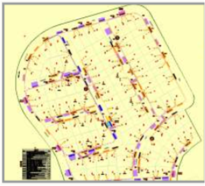
A leading national broadband service provider in Australia, wanted fiber network design and drafting services as part of the larger national broadband services rollout program (FTTP).
Solution:
RMSI is providing network planning and design services in both CAD and SpatialNET technologies. Key solution highlights include detailed study of the existing infrastructure, route designing with pit and pie for field survey and rod&rope, designing considerations, detailed designing of other passive optic network (PON) elements, detailed documentation such as Bill of materials, Bill of Quantities/Services, Splicing details, SLDs and CAPEX details, updation of As-builts and building network connectivity in GIS and updation of asset information fom As-builts into physical network inventory database.
RMSI also developed a structured project management workflow to ensure seamless coordination of work between offshore designers, and on field surveyors and network construction vendors.
Wireless Network Engineering
 Background:
One of the biggest telecom operators of UK placed an order for 2D and 2.5D databases for rolling out next generation network across all important urban areas and countrywide UK. The customers R.F. planning needs were successfully met with a state of the art technology to fulfill the demand of quality integrated datasets.
Solution:
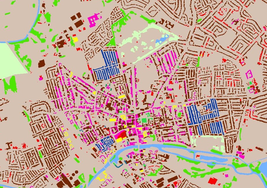
2D databases were created using Landsat 8 satellite images for country wide UK at 25m resolution. The data was classified into 21 classes. Remote sensing analysis and interpretation techniques were used to create an accurate dataset.
For the urban areas, a detailed data that also includes height parameters is critical for accurate planning. The 2.5D data was a unique one of its kind solution where a height range was assigned to each building block and the data was delivered in raster format at 4m resolution.
The built up area itself was categorized in 12 different classes based on building height with the total number of clutter classes being 21. The height information was incorporated through visual interpretation with reference to information available over the public domain.
The data covering 944 cities and approx. 27,500 sq. km. was delivered successfully with high quality and before time.
Client Benefit: These databases helped the client in urban scenarios where the complex man-made structures and vegetation play an important role in R.F. planning.
 Background:
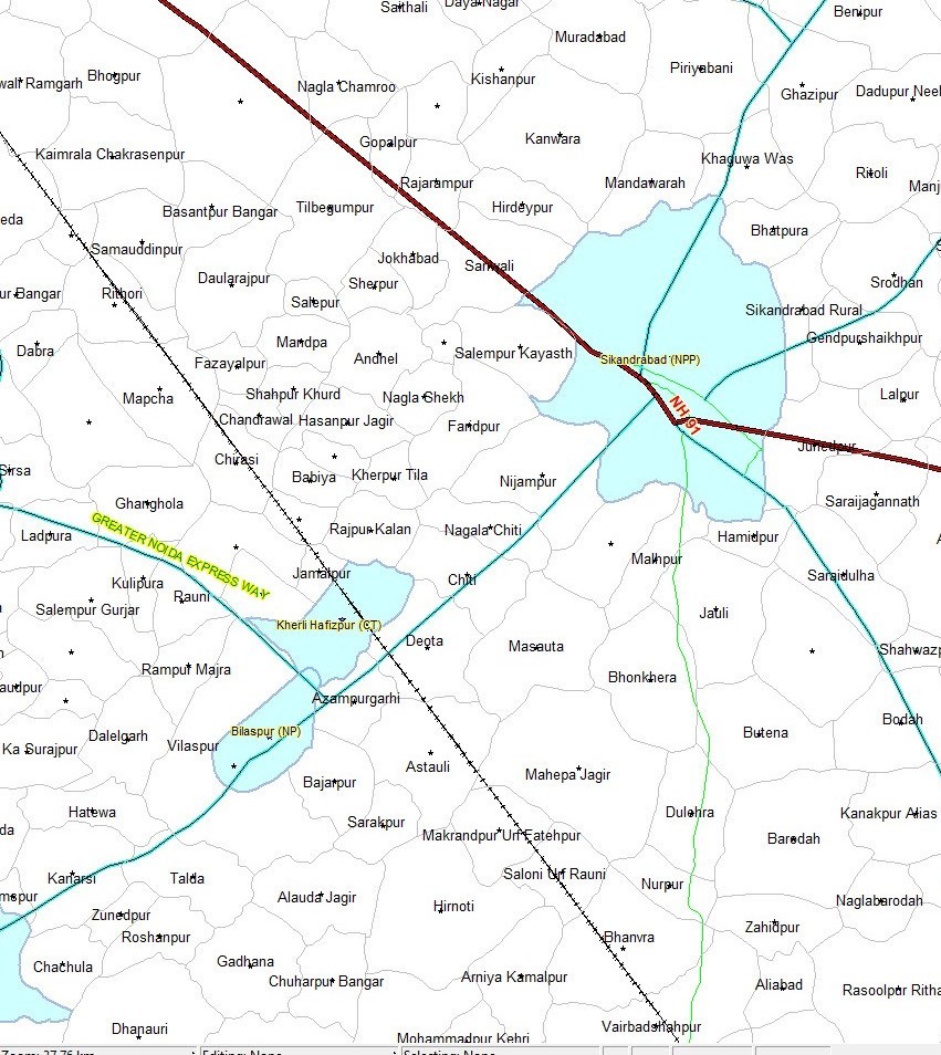
The client is one of the leading multi-lateral funding agencies in the world. For effective management of their projects in India the customer wanted latest and most accurate databases updated according to the Census data (2011). The deliverables included state, district, sub district and village level administrative boundaries with accurate geo-referencing of maps, digitization of boundaries, attribute assignment and their analysis.
Solution:
The project involved scanning, geo- referencing, digitization and attribute assignment upto village level. For seamless data preparation, edge matching and mosaicing was carried out at state, district, sub-district and village levels. After preparation of seamless spatial data, coding of the polygons was applied using Census 2011 MDDS code guideline. Data was aligned with respect to natural features on high resolution satellite images available over public domain.
Client Benefit:
The administrative boundaries delivered to the client were upto date and much closer to ground reality as compared to the source maps. Client received all processed output raster & vector data in required projection & GIS compatible formats within cost and on time.
 Background:
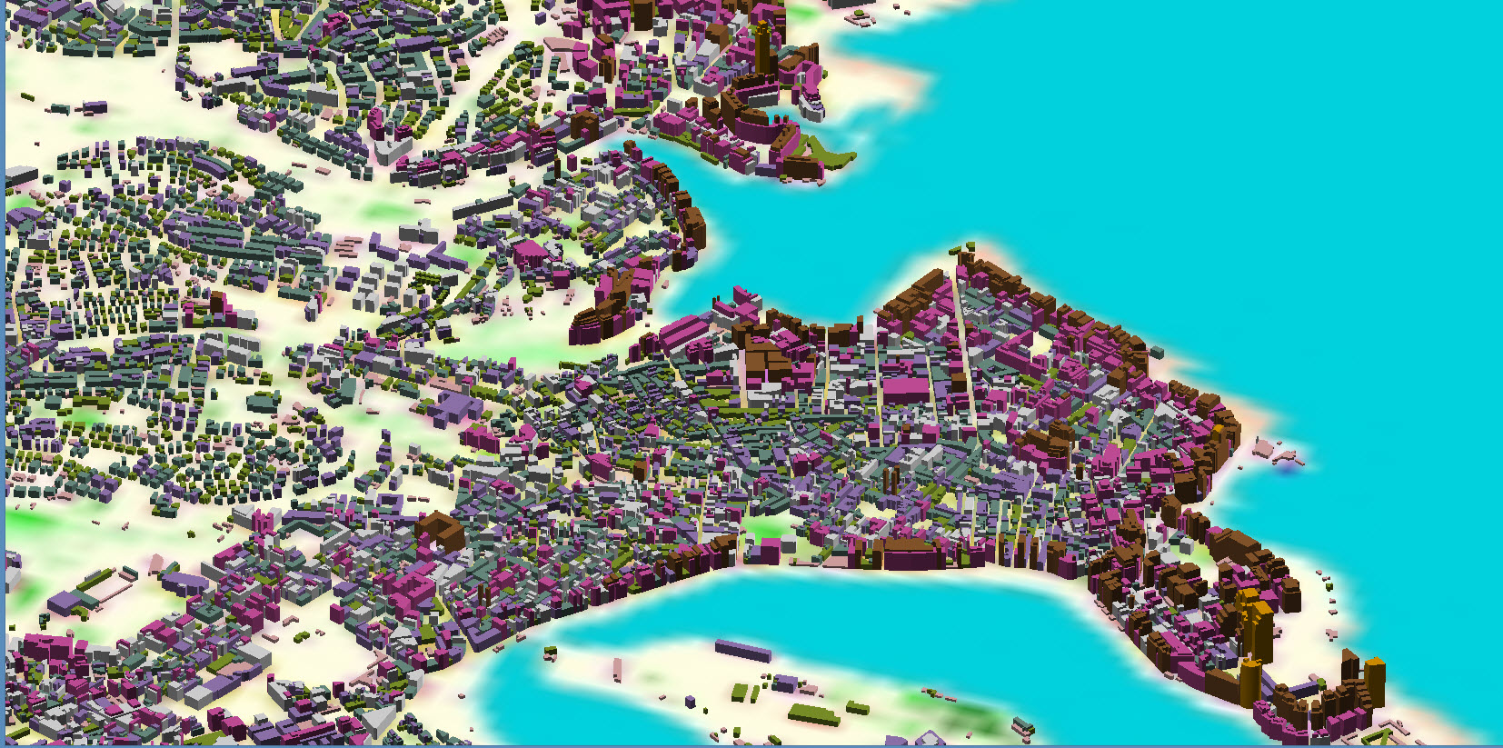
The client is one of the biggest telecom operators of Europe and across the world. The requirement was for vector 3D building footprints of countrywide Malta with AGL, MSL Height in ESRI shape polygon. Data capturization using RMSI’s approach required less turnaround time in comparison to traditional photogrammetry techniques and helped to make the solution more cost-effective.
Solution:
The challenge was to create a cost effective 3D data solution where quality of both the building shape and height is at par with the accuracy and acceptance criteria set by the client and it was met with a technological evolution in the form of a proprietary Stereo Suite tool.
The 3D data was created using stereo satellite image (GeoEye/WV-02) with a resolution of 0.5m/0.6m. For 3D building footprint creation, ATed stereo satellite imagery along with our in-house developed tools was used. The proprietary tools used in the project were quite simple and user friendly and helped to ramp up the team size quickly to deliver the data on time.
The vintage of data was 2015-16 and x,y and z accuracies were maintained within (+/-) 3m.
Client Benefit:
The data provided by RMSI was a top-notch solution along with the benefits of cost effectiveness. The client was provided with DTM, Clutter data as well as vector data for linear features along with 3D building footprints to significantly improve its existing network coverage.
LAND AND INFRASTRUCTURE
Land Policy & Reforms
Background
A state authority responsible for the registration of property transactions in Ireland.The client intended to implement a digital mapping system that was capable of efficiently loading, storing, updating and delivering Ordinance Survey, Ireland (OSi) large scale data in combination with digitized land parcel information. The client wanted RMSI to create and attribute seed points for all the registered land parcels in the 26 counties of Ireland and subsequently capture the boundaries for all these land parcels using various input data provided by the client.
Solution
RMSI sequentially divided the entire project into the following two distinct phases:
In the first phase, seed points for an estimated 2.4 million land parcels were created. These included about 1.6 million folios falling in all the 26 counties in Ireland
In the second phase, land parcel boundaries were captured using different data inputs. Seed points and parcel boundaries were captured using OSi landline vector data, land registry maps, multi-storey books and filed plans, geo-directory data, imaged folios and Integrated Title Registration Information System(ITRIS) database. Some of the key activities that were performed during the second phase of the project included.
• Capturing relevant information from the imaged folios
• Geo-referencing all the land registry maps of various vintages, scales and quality and other mapping inputs
• Creating seed points for all the 2.4 million land parcels, using geo-directory points (wherever relevant) and assigning the required quality flags and attributes.
• Capturing boundaries for all the land parcels using defined business rules and multiple input sources.
• During project execution, a web based “Query Management System” was also set up for resolution of queries with the client.
Client Benefit
Client received a complete GIS dataset for all registered land parcels across 26 counties in Ireland. Integrating this dataset with a client developed software application simplified the process of marking discrepancies on the old hard copy paper maps of land parcels and facilitated in effective and quick decision-making.
Background
The client is a government body managing various schemes to promote agriculture, fisheries, food, forestry, and rural affairs in Wales. The client was referring to various agri-environment schemes running on different systems, for the purpose of releasing subsidy payments to the farmers. Due to the different systems, they had different data/shapes for different parcels (land holdings).
To conform to the European Union (EU) guidelines, the client wanted to develop a centralized system that could support multiple agri-environment based subsidy schemes to ensure consistency and check double funding to farmers. RMSI, together with consortium partners Landmark Information Group and Siemens Business Services was assigned the project to create the system for the client.
Solution
The project was divided into two distinct phases, the data transition phase and the development of the system for handling multiple business requirements and farmer’s data (about 20,000 plus farmers data).
Phase 1: In the data transition phase, RMSI developed a desktop based system to perform spatial editing, and migration of existing data to the new system as per the new system design. The key elements of this system comprised an online web attribute editor, and a spatial editor.
Phase 2: The next phase involved creation of a web based system with a centralized database for all the relevant schemes administered by the client. The key features of this system include:
- A Web Based Online Viewer, to thematically view, query and plot the areas of interest (AOI)
- A Scheme Editing System, created on an ArcGIS Engine that has easy to use robust editing features
- An Offline Field Markup System, to enable the field officers to digitally mark up changes to a parcel
- Plotting/PDF Generation, a tool to facilitate single/batch plotting in different templates, and creation of plots as PDF’s
- Data Synchronization, to help synchronize the base data and the markups between the field mark up system and the editing system
Client Benefits
- Centralized system to update and maintain data for multiple schemes
- Automated cross-checking to identify and stop dual funding – accurate measurement of land, identify erroneous references and duplicate claims
- Resolve agricultural parcel conflicts faster and result in time & cost savings for both the client and their beneficiary end-users.
- User-friendly interface that allows even non-GIS users to operate the system easily
.
Background
The client commissioned RMSI to develop a National Land Information System (NLIS) to support the Government’s overall land reform policy.
Solution
The project specifications and requirements were jointly identified by the client and RMSI. The overall system was developed using ESRI ArcGIS server technology and a centralized Oracle database to store land information.
The RMSI team set up the entire infrastructure for NLIS including national WAN capability evaluation; setting up servers, networking infrastructure across the country, and enterprise storage; and building business continuity and disaster recovery infrastructure.
The NLIS was developed using a scalable infrastructure to match the growing future usage – both in terms of the transactional volumes and number of users. The system can be accessed from all specified locations across the country via intranet or internet. It is envisaged that in future the general public too will be provided access to the system.
Client Benefit
Land use, land valuation, land quality, and land condition for both urban and rural areas was automated using NLIS. The system enabled online assessment and collection of land fee payments (land rent/tax) and valuation and web based maintenance of large-scale cadastral maps data.
E-Governance
Background
Government Departments within the Indian state of Rajasthan were using traditional paper maps and historical field survey data for their administrative functions such as town planning, traffic management, power, drainage, forestry, mining, and natural resources. The individual databases resulted in duplication of efforts, considerable waste of time and resources and use of different data for their respective functions. To overcome the above issues and achieve operational excellence, the client wanted to implement an Urban Information System with a centralized geodatabase for six principal towns in the state -Bikaner, Jaipur, Jodhpur, Udaipur, Kota, and Ajmer.
Solution
RMSI in consultation with the client undertook a detailed User Needs Assessment (UNA) to better understand the client’s requirements and come up with the best fit solution. RMSI commissioned a dedicated team that comprised software, GIS, and remote sensing experts.
Based on the UNA, RMSI developed an Oracle based system with a customized user interface. Key features of the system include user and grievance management, navigation, routing, spatial data editing, and report generation. Furthermore, the system also supports various master and zonal development initiatives of the state government.
The team designed and created a systematic multi-layered and multi-scale geospatial database to act as a centralized information hub, and store both spatial and non spatial components. The project also involved hierarchical mapping of cities at 1:10k, 1:2K and 1:1K scales and undertaking ground surveys to detect and map underground assets such as sewer and water supply networks.
In addition to developing the information system, RMSI also trained selected state government officials to administer, utilize, update and, manage the urban information system.
Client Benefit
The system enabled more accurate, informed and insightful decision making by all the state government departments. Using a centralized database ensured that there is no duplication of efforts and all departments use the same updated data.
Background
A UK government body, responsible for managing various government schemes relating to the promotion of sports activities across the country.
The client wanted to consolidate all existing information on sports facilities in England. So far this information was maintained by separate sporting organizations and suffered from inconsistent information, varying in quality and accuracy, and produced in different formats. The client decided to create a web based system and a single authoritative database of sports facilities in England.
Solution
End to end development of the solution included data collation, data rationalization, conceptualization, development of the portal, hosting services, remote web site management, and application maintenance. The portal uses W3C specifications and guidelines that forms the core standard for data transfer and presentation of existing sports data in England. Key activities included:
• Active Places Development: Designed a robust and reliable system, with a user friendly interface, and the ability to do complex attribute based searches. The system incorporated tools for selection, analysis, and presentation of spatial data for different types of users
• Data Matching and Synchronization: Automatic data matching via a customized software application, and manual data cleansing using an interactive software application. Data correction, using local knowledge and reference data sets, with manual and automated quality checks.
Client Benefit
The portal enabled users to find information about sports facilities anywhere in England using interactive location maps and additional detailed information. The system also provided planning tools to help National sports-governing bodies and local authorities audit sports facilities and develop planning and investment strategies.
Smart Cities
Client
Abu Dhabi City Municipality was established in 1962 as the “Department of Abu Dhabi Municipality and Town Planning.
Business Need
The Smart tenant will be one of the forward looking web applications that will focus on evolving as the user choice when it comes to property search in Abu Dhabi. The project is intended to develop a web application and mobile application (in android and iOS) that will use the map services and web services available with several government agencies in Abu Dhabi. The data and information contained in the SMART TENANT comes from other government systems thus it is authentic and user information stored in the system is also stored in the database under government control and will be used for the intended purpose only.
Solution
It is the Endeavour of Department of Urban Planning and Municipalities, Abu Dhabi to organize and develop the real estate market by strengthening the relationship between property seekers (prospective tenants), tenants and property owners. The department has developed a system called “Tawtheeql” for recording rental transactions in Abu Dhabi. Apart from this, other systems provide geospatial information like GeoSMART operated by Abu Dhabi Systems and Information Centre (ADSIC).
This project focuses on developing a web and mobile application for the use of property seekers, property owners and property agents to search, post available properties for lease based on their search criteria. This application will act as a decision support system for property seeker who is looking for a suitable property and has multiple criteria for choosing the same. The web application will be developed with necessary functionalities that will help the administrator manage users, properties, generate reports besides other functionalities. Mobile application will be developed in Android platform that will be user friendly and have impressive user experience.
This project is conceived by the Department of Urban Planning and Municipalities
- To make the process of searching a property for rent in Abu Dhabi easier and more reliable
- To get the list of verified agents in the region
- To get the listing of properties posted in the region
- To get the sector wise and zone wise property index in Abu Dhabi
- To develop bi-lingual (English and Arabic) web and mobile application capable of property search from the database or the listing services of the agency
- To develop the web and mobile application capable of agents search
- To develop rental index module that calculates the rental index zone and sector wise and display as a heat map in the map view.
- To develop rental calculator module that allow tenants to provide mandatory values and calculate the increase in rental value for the selected property.
The whole purpose of this project revolves around making the life in Abu Dhabi easier for tenants by getting easy access to property information. This application also makes it easier for the tenants to get rental index value calculated using the values from the Tawtheeq.
Benefits
- Tenant is able to find the rent property in Abu Dhabi
- Application provide the solution for calculate the rent amount with tax
- Search the agent for property
- This application is capable of providing real-time details of Rental Index.
Technologies used
.Net/MVC, Esri Map, Objective #C, Android and SQL Server 2014.
SUSTAINABILITY
Resilient Communities and Infrastructure
 Besides dwelling on beauty, Jammu and Kashmir is highly susceptible to natural disasters. The entire region is in seismic zone IV and V, which makes it highly vulnerable to earthquake. As part of the reconstruction activities of 2014 Jhelum flood, the Government of J&K with the support of the World Bank has executed several disaster mitigation and risk reduction initiatives in the Union Territory. One of the key initiatives was carrying out the multi hazard risk assessment study of J&K which helped in understanding risk and formulating risk mitigation strategies.
RMSI carried out hazard assessment (frequency and magnitude across space), and risk (in terms of economic losses and affected population) for several hazards such as earthquake, landslide, flood, flash flood, avalanche, GLOF, forest fire, drought, climate variability, and industrial hazards.
Solution
The multi-hazard risk assessment study enabled the Government and stakeholders in devising effective sectorial risk reduction strategies to ensure the UT’s risk resilient development planning. The key deliverables included:
- In-depth analysis of hazard risk from principal hazards affecting the State
- Development of Web-based Disaster Risk Database (DRDB), and an Integrated Operational Forecasting System (IOFS) for hydro-meteorological hazards (particularly flood and drought) to provide real-time forecast and warning
- Training and capacity building to utilize the above platforms and models for UT development planning
RMSI has carried out detailed hazard modelling of the hazards (probabilistic and deterministic approach based on the data availability), exposure database development, vulnerability assessment (conducted UT wide social vulnerability survey and physical vulnerability survey) and risk assessment. Using DRDB, the user can generate risk profile as per certain defined hazard scenarios, or at administrative level (UT, district or tehsil).
The IOFS has integrated the IMD forecasted weather data that generates warnings in an automated manner and releases it in the form of warning bulletins for flood, flash flood, avalanche and drought. A three-day forecast is provided in case of flood, flash flood and avalanche, while for drought, extended forecast for a month is provided.
Benefit
Aligning to the Sendai Framework, the study quantified hazard and risk across region and development sector. This will help the government in implementing risk mitigation strategies for sustainable development in the Union Territory.
 Background
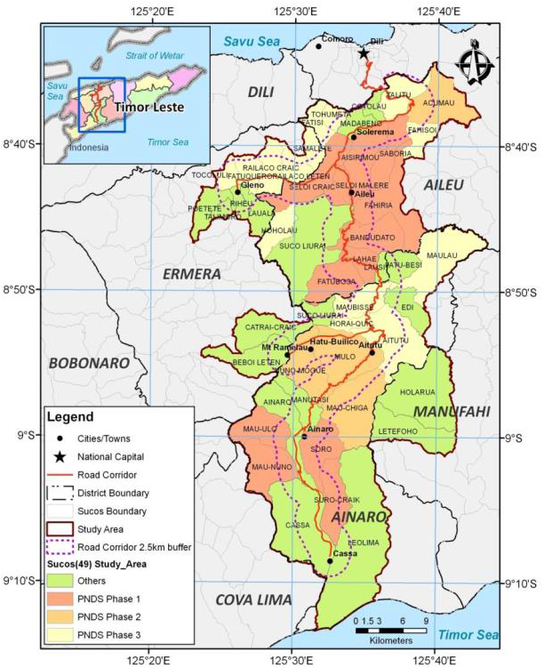
The study entitled “Natural Hazards Risk Assessment in Communities along Dili-Ainaro and Linked Road Corridors” was undertaken under a bigger program Building Climate and Disaster Resilience in Communities along Dili-Ainaro and Linked Road Corridors Project- Component 1: Natural Hazard Risk Assessment. The World Bank supported this study for Timor-Leste to better understand hazard risk profile of 49 Sucos along Dili-Ainaro linked road corridors project for implementation of Suco Community-Based Disaster Risk Management (CBDRM) program.
The project was part of the larger program for Building Climate and Disaster Resilience in Communities along Dili-Ainaro and Linked Road Corridors covering Ainaro, Aileu, Ermera and Manufahi Districts. This project has three components of which the first component was to carry out hazard vulnerability and risk assessment of these districts focusing on Landslides, Flooding and Strong Wind Hazards. The second and third components were toward strengthening institutional capacity and for Delivering Community-Based Disaster Risk Management and develop Community-Based Disaster Risk Management and Adaptation Plans and Pilot Projects.
Solution
RMSI project team has developed Hazards models and detailed building level exposure data development. The team also carried out detailed vulnerability and risk assessment at Suco level in Ainaro, Aileu, Ermera and Manufahi Districts Focusing on Landslides, Flooding and Strong Wind Hazards. The analyses have been carried out by applying international best practices of probabilistic hazard assessment adapting them to local conditions. The team has carried out detailed analyses of social vulnerability, capacity building of local organizations, and shared all the data on SOPAC/SPC GeoNode for wider dissemination. In addition, detailed final reports were prepared and submitted.
Client Benefit
Timor-Leste National Disaster Management Directorate (NDMD) and other key stakeholders were provided with trainings and capacity building activities under this project. As part of inclusive approach NDMD officials were involved and various activities of the project including field-survey investigations. Detailed social-vulnerability analyses were carried out for all the Sucos. All the datasets under this study were developed in GIS and to handle that select key officials of stakeholders department were also given hand-on training in QGIS. The key stakeholders were provided with detailed building level exposure data in GIS for all the 49 Sucos and high-resolution Digital Terrain Model (DTM) for the study. Risk assessment results including risk matrix (PML, AAL, LEC plots) were provided at Suco (village) level. All the hazard, exposure, vulnerability and risk modeling for floods, strong winds, and landslides were carried out using Open Source state-of-art applications. Suco level hazard risk profiles (Risk Atlas) were developed that are being used for implementation of CBDRM at Suco level. All the databases developed under project and, technical reports were handed over to NDMD as well as on SOPAC/SPC GeoNode for wider dissemination.
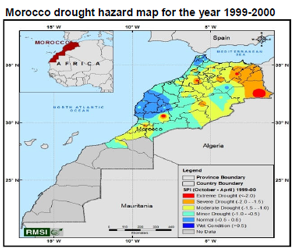 Background
The client commissioned RMSI to undertake this study to assist the Government of Morocco in determining the risk arising from natural hazards (floods, earthquakes, tsunamis, droughts, and landslides) and to perform a comprehensive assessment of exposed assets and quantify losses probabilistically, due to sudden onset of natural disasters.
The results of this study will be used to develop a National Disaster Risk Management and Financing Strategy (NDRMFS).
Solution
The study assessed the risks and vulnerability associated with floods, earthquakes, tsunamis, droughts, and landslides.
Probabilistic risk assessment models were developed to estimate the economic impact of these hazards based on events of different frequency and severity on various types of exposure. The models were further used to evaluate various mitigation options to support development of a national strategy. The assessment components included:
i. Hazard Assessment – evaluated the severity of various hazard events associated to a location and having different frequencies of occurrence. Using their severity analysis, hazard maps of various return periods were created.
ii. Exposure Analysis – analyzed the housing stocks, the various dimensions of demographic data, industrial and commercial buildings, essential facilities (such as hospitals, police stations, fire stations, and schools), infrastructure (including utility systems and transportation systems), and agricultural exposure (in terms of various types of crops).
iii. Vulnerability Analysis – based on the exposure analysis, developed vulnerability curves for various exposure elements in terms of mean damage ratio (MDR), which defines the expected proportion of asset damage corresponding to the intensity of the hazard.
iv. Assessing Direct Loss Potentials – analyzed and quantified the damage caused by these hazard events of probable severity and frequency on the exposure to arrive at direct loss figures in monetary terms. The loss was presented as Average Annual Loss(AAL) and Loss Exceedance Curve(LEC)
v. Assessing Indirect Economic Loss Potentials – provided a macro-economic structural model to identify the economic sectors that were affected by the hazards and their interdependencies.
vi. Developing a Risk Assessment Software – incorporated the probabilistic risk assessment models into GIS based risk assessment software named MnhPRA (Morocco natural hazard Probabilistic Risk Assessment). The platform has been developed on top of open source GIS and database technologies.
vii. What If Scenario Analysis: based on the assessment of this current risk, a set of possible mitigation options were identified for reducing the risk. A benefit cost analysis was performed for prioritizing various mitigation options.
viii. National Strategy –based on the outcomes of the what if scenario analysis, a draft national strategy document would be created and submitted to Morocco government for finalization.
Client Benefit
• Assist the Government of Morocco to determine the current risks from natural hazards to various assets
• Help develop a National Disaster Risk Management and Financing Strategy (NDRMFS) to formulate and evaluate mitigation measures for DRR.
• Developing an understanding of what could be done to reduce their risk along with associated benefits and costs.
• MnhPRA will make it easier to mainstream risk assessment for disaster risk reduction in Morocco
Background
Romania is severely exposed to a range of natural disasters, particularly the risk of earthquakes, floods, and landslides causing economic and human losses across the country. Very limited insurance cover against earthquake and flood is purchased. The Government of Romania, within the framework of the loan obtained from the World Bank entrusted the Ministry of Administration and Interior (MAI) with the responsibility of implementing an Integrated Disaster Risk Management Study. This study aimed at quantifying the exposure and vulnerability of the housing stock to the risk of earthquakes, floods and landslides in order to assist in the implementation of the proposed Romanian Catastrophe Insurance Scheme (RCIS).
Solution
Region specific probabilistic loss estimation models were developed to compute earthquake, flood and landslide risks in Romania at the commune level resolution. The loss computation models enable users to compute peril-wise Average Annual Loss, Return period loss and insured losses for residential buildings in Romania based on the proposed Romanian Catastrophe Insurance Scheme (RCIS). The model was delivered to the client in the form of a simple and user-friendly application software along with residential exposure database and associated vulnerability functions. Furthermore, the client would be trained to use the software through on-site training sessions and seminars.
Client Benefit
The study output would enable better understanding of the frequency, severity and spatial distribution of the earthquake, flood and landslide risks in Romania. The client could plan for proper risk transfer mechanism once the model results reveal the gap between absolute and insurable risk.
Climate Change
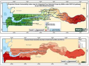 The Ministry of Environment, Climate Change and Natural Resources (MECCNAR), Government of Gambia, has undertaken measures to build climate resilience by assessing the potential impact on agriculture and health sector, and coastal infrastructure. Hence, the project aimed to carry out vulnerability assessment and gap analysis studies to aid in implementation of the Gambia’s Strategic Programme for Climate Resilience.
Solution: Key activities included-
- Vulnerability assessment of agricultural and health sectors to climate change across rural and urban areas and different eco-systems in the Gambia
- Assessment of climate-resilient livelihood options across socio-economic areas
- Feasibility study on implementing Weather Index Based Crop Insurance System in the Gambia to enhance climate resilience of communities in both rural and urban areas
- Vulnerability assessment of coastal infrastructure to climate change and identify adaption options for developing a climate-proof coastal infrastructure
Benefits
This study will help the Government of Gambia in preparing and implementing a robust strategic investment plan to build resilience to the impacts of climate change in the agricultural and health sector, and coastal infrastructure.
 Background
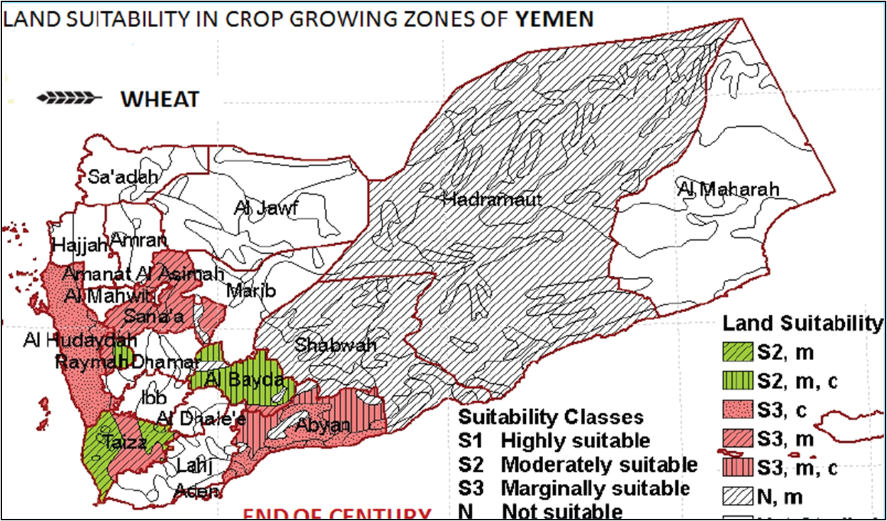
The objective of the study was to assess climate change induced spatio-temporal shifts in natural and rainfed agro ecosystems in four countries from the MENA region (Morocco, Tunisia, Syria, and Yemen) and to understand the implications of these changes for development planning.
Solution
RMSI experts used internationally recognized methodologies for projecting future climate and isolating climate variables as agents of temporal and spatial shifts in natural and agro ecosystems. Three state-of-the-art global climate models were used under two greenhouse emission pathways in conjunction with agro-ecosystem model and natural-ecosystem model to assess the climate change induced impacts on the agro and natural ecosystems for the four selected countries.
Client Benefit
The findings of the study showed that rainfall variability and temperature are projected to increase in all countries through the end of the century, causing major biome shifts in natural ecosystems and decreasing suitability of crops in rainfed agro-ecosystems except for Yemen where a positive shift is expected.
 Background
The study entitled “Development of Climate Information System for Enhanced Climate Resilience in Yemen” was undertaken under Yemen’s Pilot Program for Climate Resilience (PPCR) – Investment I: Climate Information System and PPCR Coordination. The World Bank supported this activity for Yemen to better understand current and potential future climate, particularly on finer spatial scales, understand how their populations may be vulnerable, and to tailor their adaptation responses and thus ascertain climate-resilient growth in the future.
Yemen does not have good spatial coverage of weather monitoring stations, resulting in an array of unknowns regarding baseline climate in the country and its neighborhood. The need for continuing, long-term data on weather and climate is related to prudent stewardship of resources and the protection of life and property. The assignment calls for formulating a framework towards development of a robust national climate information system which includes:
• Preparation of a base document for identifying the gaps in the existing infrastructure, and the need assessment,
• Provision for improved observations of the state variables and forcing with modern in situ and remote observing systems,
• Infrastructure including hardware/software (for quality control, processing and analysis ) and telecommunication system needed to archive and process the weather and climate data and understand them,
• Improved ability to set the climate data system in a coherent physical (and chemical and biological) framework with application of physically consistent models and tools,
• Develop design of a geospatial display system through linkages including data exchange protocols between various national agencies based on comprehensive assessment of the existing facilities in the nodal agencies of Yemen.
The proposed Climate Information System should be extremely valuable for early warnings aimed at a myriad of practical applications for business, industry, government, and the public.
Solution
We proposed a detailed framework on modernization of the observing/monitoring networks based on our robust assessment of the existing facilities in the key national nodal agencies dealing with or using information on weather and climate and in specific sectors such as water and agriculture including disaster management.
A detailed plan for modernization of the ICT facilities including Computer hardware with adequate storage and processing facilities at identified national organizations for real time collection, storage and processing of data from networks with telecom facilities linked to data loggers at sites, computer software for quality control, processing and analysis, updating communication equipment of all observing networks, strategies for strengthening the National Data Management System, including archiving and data rescue, and design of a geospatial display system through linkages including data exchange protocols between various national agencies based on comprehensive assessment of the existing facilities in the nodal agencies of Yemen was developed.
A National Framework / Memorandum of Understandings / Protocols for the development of Climate Information System was designed for the nodal agencies including (a) establishing a framework for Climate Services identifying the roles and responsibilities of all stakeholders providing / utilizing climate data and information, (b) establishing a national standard for climate data and information systems (quality control as per WMO GFCS), (c) establishing communication channels and cooperation mechanisms for data and knowledge exchange, (d) identifying training needs at individual / institutional levels for relevant stakeholders, (e) identifying business requirements for design and implementation of CIS and for related reports / information products, (f) identifying final products of the CIS, and (g) identifying mechanisms for cost recovery was developed.
Client Benefit
The clients were provided with a master plan to integrate climate risk and resilience into core development planning, while complementing other ongoing development activities in Yemen, meteorological, hydro-meteorological and agro-meteorological networks, need to be installed/refurbished across a wide geographical area of the country. The proposed climate information system consisted of details on a large number of automatic monitoring stations, telecommunication systems, databases, and application software for the users, including some installations/refurbishments in remote locations in order to effectively address climate risks and vulnerabilities within the country. A detailed plan for long-term institutional capacity building and enhancement of effective service delivery systems to overcoming technical difficulties relating to methods, models, and credibility with user groups were also developed for Yemen Republic.
Background
The client was an international financial institution that provides loans to developing countries for capital programs.The client wanted to carry out a national level study for Malawi and Mozambique to help the client in assessing the probability of droughts and floods in light of future climate change predictions. The study also included determining the extents of vulnerability to respective economies from these two natural hazards and helping them identify appropriate mitigation measures.
Solution
RMSI carried out probabilistic hazard and risk modeling of droughts and floods involving a five-tier methodological framework to conduct the study , that included :
• Analysis and paramatization of historic weather data which contributed to the understanding of “Future Climate” under projected climate change scenarios
• Analysis of drought and flood hazards data from extensive hydrological and meteorological data as well as expert opinion to determine the frequency and severity of events
• Agro-meteorological analysis to calculate the reduction in yield for drought or flood events for two major crops.
• Macro-economic analysis to compute direct and indirect economic losses
• Evaluation of mitigation scenarios and propose appropriate adaptation strategies
Client Benefit
The study enabled International Agencies and the Governments of Malawi and Mozambique to better understand the frequency, severity and spatial distribution of drought and flood risks and their impact on agricultural productivity & to evaluate economic impacts to shape future mitigation strategies.
Background
The study was part of the client’s program on promoting climate change adaptation in Asia and the Pacific. This study aimed to build on the ADB country program strategy paper to present an analytical modelling base study of Lao PDR climate change and flood risk assessment for eligible sectors as qualified by agriculture and natural resources strategies objectives.
The objectives of the study were quantification and modelling the risks arising from floods in order to provide a scientific and numerical basis for weather and climate risk management practices and policies. Key project activities included:
• Hazard model formulation consisting of database development, climate change scenario analysis for rainfall and temperature, hydrological model development, and study of the impact of climate change on water resources;
• Development of Soil and Water Assessment Tool (SWAT) model to estimate runoff under current and climate change scenarios (ECHAM4 model);
• Flood risk assessment for infrastructures: irrigation, roads, and for agriculture (rice crop); and Review of climate change adaptation measures.
Client Benefit
The outcome of this study served as a basis for incorporation in risk reduction strategies and prioritization of the country’s development planning.
Water Resources
Rapti River in India and its tributaries (Burhi Rapti, Banganga, Ghonghi, Rohin, Chandan, Ami and Gurra) are highly flood-prone, with recurring floods causing huge loss to crops, property, human and cattle life. RMSI is carrying out a project for the Rapti River Basin in Uttar Pradesh to reduce the loss caused by recurring floods. The project objective is to reduce loss caused by recurring floods by developing comprehensive suite of models to improve flood forecasting in the Rapti River Basin, creating an inundation mapping model based on Digital Elevation Models (DEM) data to predict extent, time of arrival, duration, and depth at community level, and developing tools for disseminating warnings/alerts to public, institutions and communities.
Solution: RMSI’s technical approach is based on applying international best practices in flood modelling and real-time flood forecasting, and adapting them to Indian conditions. The key activities included:
- Review of current flood forecasting and inundation modelling
- Development of flood forecasting model and flood inundation model
- Tools for information dissemination
- Post implementation support and capacity-building sessions
Benefits:
The system provides forecasts as early as three days before the event’s occurrence, enabling the Agencies to take necessary action for the safety of population to be affected. Real-time flood forecasting system is critical in providing accurate warnings with a suitable lead time for the emergency response teams to take necessary actions to minimize loss to lives, communities, and infrastructure.
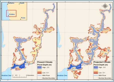 The client wanted to assess the change in urban flood risk due to climate change. The study involved use of climate model projections to understand how climate change might affect the annual probability of a rainfall event like 2005 flooding. This helped in understanding if climate change could make events like 2005 more frequent. Further, a hydraulic model was used to study the impacts of climate change for flood risk, in terms of the changes in population exposed and the potential economic damages.
The findings of the study showed that, the overall costs of damages from flooding could rise significantly in a warming climate.
The main objective of the study was to evaluate potential climate change risks, impacts, and develop adaptation measures associated with th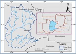 e new KGL Hydropower Project on the Kafue river in Zambia. RMSI adopted advanced hyrdrological and hydrodynamic modeling approached for the assessment.
The study helped the client in addressing the most threating and urgent concerns and select multi-benefit adaptation options for cost-effectiveness.
Food Security
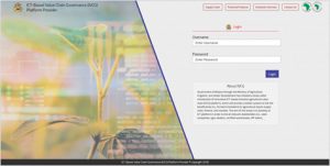 Despite immense agricultural strength, the agri sector in Malawi encountered only marginal improvements due to expensive agri-inputs (seeds and fertilizers), poor market access, and incompetent agri-technology, lack of financial credit, low investments, fluctuating prices, unpredictable climatic conditions and absence of buyers. Such factors resulted in low crop yields, and affected the livelihood of marginal farmers. There was a need for a holistic system to link farmers and marketers to agricultural inputs supply chain, finance and markets.
Solution
RMSI was commissioned to develop an innovative ICT-based Value Chain Governance (IVCG) Platform to augment the agro-input distribution system particularly among smallholder farmers and ensure higher economic returns on farmers’ produce. The key activities included:
- Location-specific database of smallholder farmers including farmers’ profile, season-wise cropping distribution patterns, crop yields, use of various inputs (i.e., types of fertilizer, seed, agro-chemicals, irrigation system, usage of farming tools & equipment’s, etc.), and financing requirements, etc.
- Management Information System (MIS) linking of agricultural value chain stakeholders
- Mapping of existing financial institutions and associated products to be availed in the agricultural sector
- Delivery of agro-inputs to farmers via stocking of agro-inputs by agro-dealers and redemption of inputs by farmers
- Management of sales transaction of the produce by the farmers to the off-takers
- Training and capacity building of the Government officials, agro-dealers, farmers, and other relevant stakeholders involved in agri value chain
Client Benefit
The innovative ICT platform will help in efficiently linking of farmers to input and output markets, extension, finance and information services, including weather services. This will reduce information asymmetries with regard to farmer-specific productivity and output, site specific input requirements, financing needs and market opportunities. Besides being an efficient and transparent system, it ensures fair prices to farmers leading to higher economic returns on land, labour and capital.
 Background
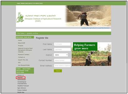
Realizing the need to increase the adaptive capacity of farming communities, the World Bank commissioned RMSI to develop an application suite of a web and a mobile-phone application to disseminate location-specific climate/ weather information, and related agro-advisories, which are understandable to the farmers on real-time basis. The agro-weather tool disseminates vital weather-forecast linked agro-advisories through SMS, IVRS, mobile app, and website for farmers to better plan and manages weather risks, and maximizes productivity.
Solution
RMSI experts developed web and mobile phone (i.e., IVRS, SMS, android app) based agro-weather tool to disseminate weather forecast information and best-bet agronomic management practices for the farmers in Ethiopia and Kenya. The tool was developed for the main cultivated crops in Ada’a district of Ethiopia (chickpea, lentil, teff, and wheat) and in Embu district of Kenya (bean, maize, sorghum, tea, and coffee) on a pilot basis.
Client Benefit
The key benefit is the availability of location-specific agro-advisories to farmers to minimize crop losses, and practice climate-smart agriculture.
 Background
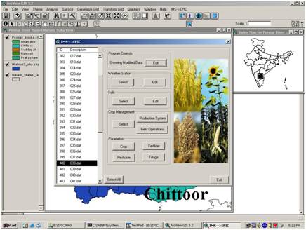
Climate variability and climate change (CV&CC) is an acknowledged threat to food security in many regions of the developing world. In the context of Indian agriculture, about 60% of the total cropped area exists under rainfed conditions and is heavily dependent on monsoon. In this context, RMSI assessed the impact of climate change on three crops (i.e., Rice, Maize, and Groundnut) in 12 river basins of India.
Solution
RMSI assessed the impacts of future climate scenarios on selected crop yields in the 12 river basins of India (Brahmani-Baitarani, Cauvery, Ganga, Godavari, Krishna, Luni, Mahi, Mahanadi, Narmada, Pennar, Sabarmati, and Tapi). Assessment was carried out using A2 SRES scenario of HadRM3 climate model for the time horizon of 2071 – 2100 in conjunction with Environmental Policy Integrated Climate (EPIC) model. Subsequently, appropriate adaptation measures were developed to overcome the negative impact of CV&CC on crop production.
Client Benefit
This study is of significant use to the Ministry of Environment and Forests (MoEF) in its policy development, contingency planning, and in building capacity to deal with the projected changes in food production.
 Background
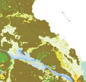
The study required agro-ecological zonation mapping at a scale of 1:250,000 using geospatial technology for ten provinces of Mozambique. Soil mapping, land cover & land use mapping, geology mapping, climate study, crop suitability and land availability analysis are part of this project. The objective of categorizing was utilization of optimum resources in terms of meeting food security and sustainable development.
Solution
RMSI created a comprehensive Remote Sensing and GIS database using satellite data and ground truth information. The various thematic maps viz. soil, geology, climate, land use & land cover are prepared under supervision of domain experts. These GIS maps are used for overlay analysis to categorize natural boundary as agro-ecological zone of the country using FAO guidelines. The database is also used for analysis of crop suitability and land availability for further natural resource management and livelihood development.
Client Benefit
The innovative solutions of the study integrate the available land resource with crop production, livestock management and infrastructure development through sustainable growth of country economics. Integration of GIS and remote sensing tools facilitate appropriate planning and management of available land resource by planners and decision makers.
 Background
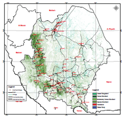
Identification, description and mapping of Rangeland sites to a scale of 1:250,000; estimation of the present and potential grazing productivity and load; and presentation of recommendations for sustainable management for each site.
Solution
RMSI created a comprehensive Remote Sensing and GIS-based database using satellite data, thematic maps, floral species inventory data and biomass estimation complemented with field expertise. The study provided ready-to-use maps for managers and decision/ policy makers to ensure Sustained and Secured Rangelands. The database also provided qualitative & quantitative information related to the benefits derived from Rangelands in terms of ecosystem services such as available biomass for livestock and other uses by humans.
Client Benefit
The comprehensive Remote Sensing and GIS database with multiple layers of information served as a key reference for evaluation, management and monitoring of Rangelands in the arid regions of the Saudi Arabia. This in particular reflects the Kingdom’s commitment towards Climate Change resilience by conserving Rangelands and its vegetation.
 Background
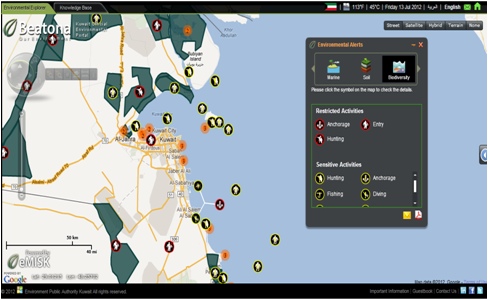
Procurement, installation and configuration of the hardware, software and networks; Environmental Monitoring Center set up; Developing an Enterprise Geo-environmental Geodatabase (data capture from satellite imagery and field survey); Design and Development of an Enterprise-wide GIS application; Design and development of an internet website for the EMIS; and User training.
Solution
Data capture, digitizing and data collection of all relevant environmental and non-environmental features in Kuwait, identified by the EPA, from the satellite images and available maps, and field verification and land surveying; Production and printing of digital and paper maps from the collected datasets; Training courses and on-the-Job training for the Environmental Monitoring Center staff on data acquisition, geo-environmental database development, updating and mapping skills. RMSI also developed a bi-lingual web portal (www.beatona.net), a knowledge based portal that serves not only the scientific environmental information of Kuwait but also garners public responses and opinions on Kuwait’s environment.
Client Benefit
The Government agency has up-to-date environment-related data of Kuwait, and technical staff’s skills have been strengthened. This has facilitated regular monitoring of the environmental status from a central location, thus aiding the decision-making process.
 Background
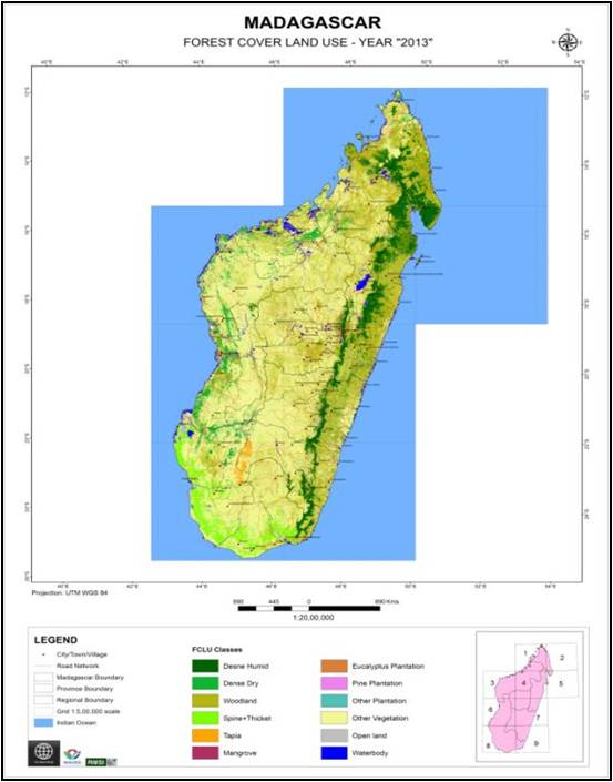
Provide data on the quantity (volume and surface areas) of existing wood resources at the end of years 2005, 2010 and 2013. This involved timber/ wood-based wealth assessment and change detection analysis using the spatio-temporal aspects of forest cover land use at the country level. Recommendations and guidelines on specific drivers by providing quick and cost effective monitoring of GHG emissions, REDD+ and Climate Change were also provided.
Solution
RMSI used satellite images of different time-periods/ years for mapping the past and current forest cover land use. The timber volume was estimated using Remote sensing and dendrometric data of all the timber species; deforestation rate was assessed and categorised into primary and secondary deforestation drivers; hands-on training/ workshops for representatives of Ministries and Institutes in wood stock data analysis, remote sensing based timber volume and forest surface area estimation were also conducted.
Client Benefit
The results of this study will contribute to the development of wood stock accounts that will be integrated into the National System of Accounts, and will serve as a key input for decision making and defining policy guidelines.
Mineral Exploration
 Background
A large multinational mining corporation with operations spanning Africa, Asia, and Australia.
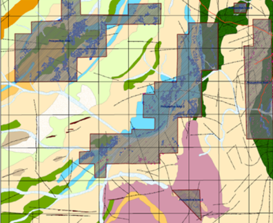
The client received a large block for gold exploration in Sudan, which was highly inaccessible. Hence, to optimize the exploration effort and reduce the turnaround time, the client wanted to undertake a geospatial and geophysical study to identify high potential gold zones.
Solution
An integrated approach of using multi-spectral satellite data and open source literature regarding the block areas were used as a reference for the study.
Structural mapping & analysis, spectral analysis including band rationing, band depth ratio and spectral curve matching using ASTER data was done for mapping the potential gold mineralized areas. Furthermore, an integrated geospatial based analysis was also undertaken to generate a model for assessing and categorizing the identified gold mineralized zones into high, moderate and low probable areas.
The study results were validated through extensive on field ground truthing undertaken by field geologists.
Client Benefit
Categorizing the mineral rich zones into high, moderate and low probability areas helped the client prioritize exploration areas, resulting in significant time and cost savings.
 Background
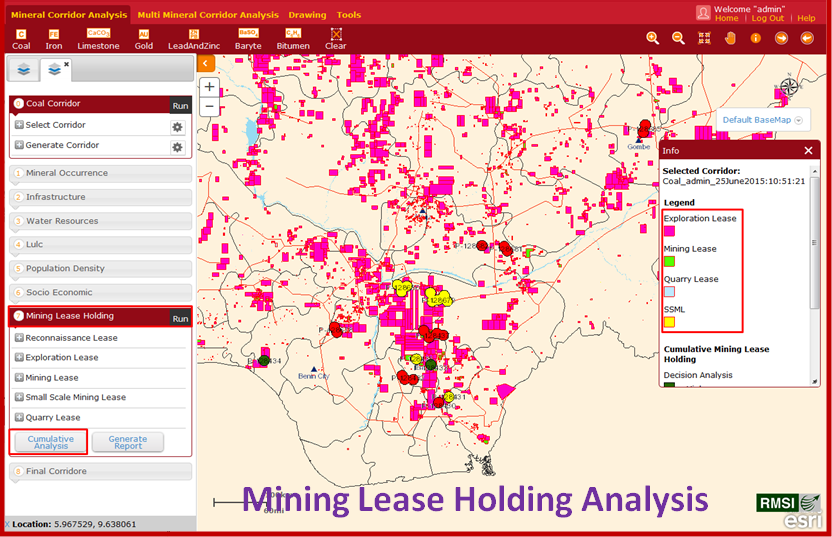
The client wanted to develop a web-based decision support system, which incorporates an integrated database of geological, mineral resources, infrastructure, and socio-economic data. The system should be able to define potential mineral resource corridors in Nigeria based on various scenarios. The key purpose of this project was to increase mining sector’s potential in the Nigeria along with concurrent growth of other sectors such as infrastructure eventually leading to growth of the country’s socio-economic condition.
Solution
RMSI team collected data on minerals, geology, landuse/ landcover, socio-economic scenario, infrastructure, mining lease holdings, population, etc. RMSI created a geodatabase on a national scale by collecting data from various departments of Government of Nigeria (GoN) and other sources, wherever applicable. The system developed is a ‘first of its kind’ web-based application on dynamic potential resource corridor in Nigeria. RMSI team created and tested various mineral resource scenarios in the application. The team provided extensive training to stakeholders.
Client Benefit
The mineral resource corridor decision support system facilitates client to accesses data, perform analysis based on various parameters, reporting and spatial data editing functions. It also allows users to upload/ update new data in the system and analysis can be done on new data. The web-based decision support system helps Government of Nigeria in decision making for any development activity related to mining and other allied sectors.
 Background
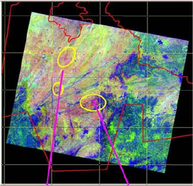
India’s only integrated producer of zinc and lead .The client wanted to locate the potential alteration zones for base metal identification in a lease area of 4500 square kilometers in the interior districts of Madhya Pradesh and Gujarat in India.
Solution
As the study area was vast, RMSI undertook a satellite imagery based study to save on time and costs for the client.
Medium resolution satellite images were subjected to spectral analysis for identification of alteration zones. Additionally, different thematic layers like geology, geomorphology, structure, drainage pattern and land use and land cover were also created alongside to relate the likely presence of base metals. Next, the project team performed an integrated GIS analysis for identification of potential zones.
RMSI used multispectral satellite data to create various thematic layers and captured the important spectral signatures that indicated the likely presence of argillic, phyllic, gossans sulphidation and phosphorous mineralization.
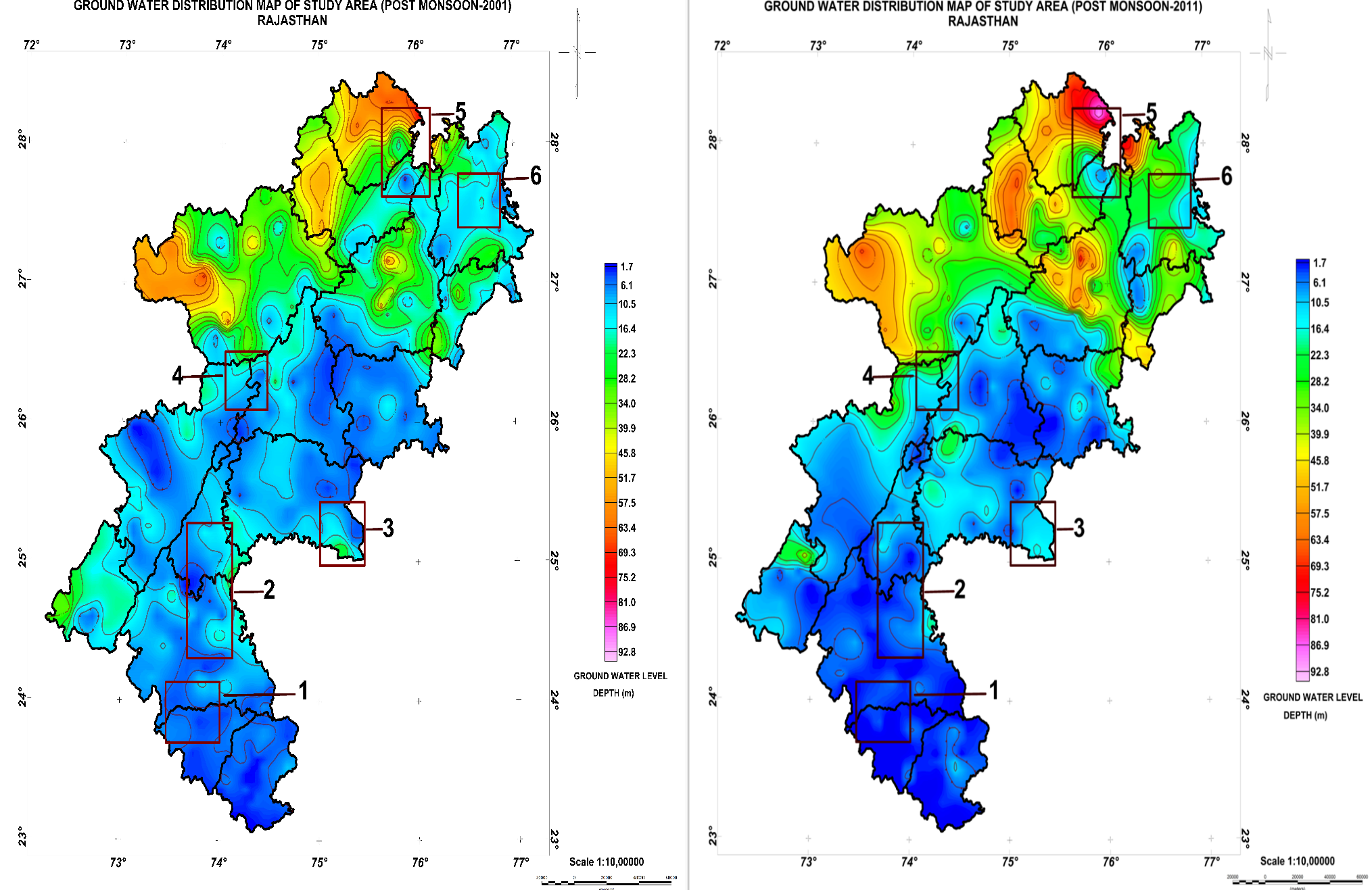 Background
The objective was to capture the existing status of Aravallis (of Rajasthan) and its mining clusters. The requirement was also to study impact of mining on the water-bodies, biodiversity and the surrounding environment of the state. In addition, as per client’s requirement RMSI proposed a management plan for sustainable mining in the area.
Solution
RMSI has carried out this first of its kind study in the country in the challenging environment of Rajasthan. Remote Sensing techniques, in-depth field validation & colossal amount of base data was sieved through, to meet the requirements of the project. RMSI has succeeded in serving the requirements of SMI and had expanded its expertise on sustainable frontend.
Client Benefit
The Mining Industry operating around Aravallis previously faced allegations of desertification. This project highlighted the economic value of mining and its social relevance. This project is also an initiative towards the sustainable-mining study of the region, which shall assist client to achieve their long-term goals.
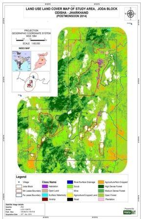 Background
TATA Steel’s iron & manganese ore leases in and around Noamundi & Joda area of Jharkhand & Odisha state form parts of Baitarani & Brahmani river basin. The client intended to carry out ‘Change Dynamic Study’ for these mining clusters to assess the direct or indirect impacts of mining (if any) in drainage course, hydro-geomorphology, soil cover, land use/ land cover and socio-economic scenario over the past decade.
Solution
The critical decadal change dynamics study was successfully executed by RMSI. Runoff modeling, drainage morphometric studies, socio-economic analysis and integrated impact assessment was the solution delivered by RMSI along with suggestions and recommendation for the most economical sustainable development practices.
Client Benefit
The change dynamic study has helped the client to understand the influence of mining on the watershed of the area. It made the client aware of the directional socio-economic growth in the area due to mining and thereby identified areas that require more attention. It has made TATA Steel take further step towards sustainable mining aiming at continuous development of its vicinity.


