Maps are the most important and indispensable tool for geographers, helping them understand and explore relationships on our planet. They are one of the most successful means of recording and communicating information about a location or spatial characteristics of the natural world, and about different societies and cultures. In today’s world, smart maps provide real-time status reports on trends and conditions that are crucial to improving businesses and making long-term strategies.
Map Intelligence with OpenStreetMap (OSM):
There are various online mapping platforms that provides mapping services across the globe, and one such popular open-source platform is OSM, a free and openly editable map of the world. OSM is a web-based public platform that collects data describing the position of roads, rivers, towns, point of interests, etc. used to create maps.
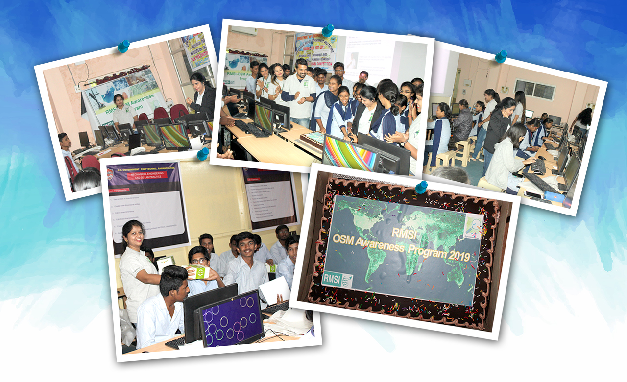
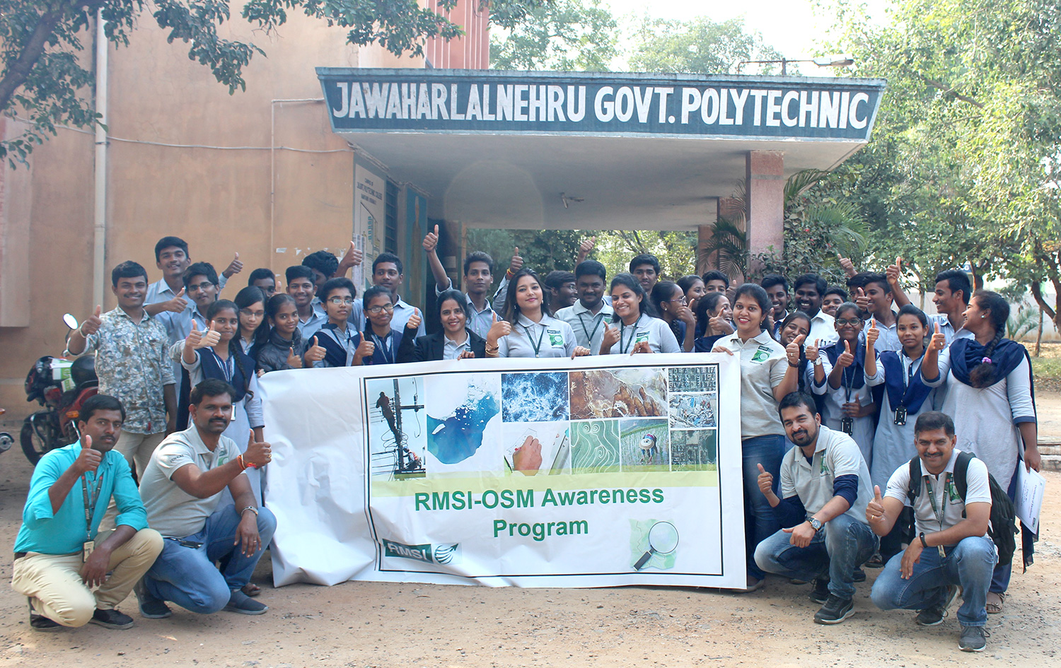
RMSI recently organized an OSM (OpenStreetMap) awareness program in December 2019, at Jawaharlal Nehru Government Polytechnic College in Ramanthapur, Hyderabad.
The goal of the workshop was to increase awareness about OpenStreetMap, its uses in times of a disaster or crisis management. It focussed on how to reduce the disaster risk and enable a speedy recovery through these maps.
To spread awareness about OSM among college students, various GIS (Geography Information System) related activities were conducted to map the areas and places around the world. The workshop was held in two modules: OSM awareness training and OSM practical training.
For this RMSI-OSM awareness program, 8 RMSI volunteers, 40 college students and youth mappers across Hyderabad, came together to celebrate geography and created new maps using OSM, the free and openly editable map of the world.
The day-long training program was conducted in six different phases. The RMSI team:
- Discussed real-time importance of GIS and MAPS in the world
- Explained the key role of OpenStreetMap in disaster management
- Conducted interactive training session on OSM editing tools
- Mappy Hours: OSM Mappers introduced a social event called Mappy Hours due to steadily growing interest in OSM across the world. Mappy Hours were conducted by organizing social meet-ups for new and experienced OSM users to discuss mapping, open-source projects and much more, by volunteering mapping across the world
- Motivated the students to learn mapping as a hobby and encouraged them to contribute map data to OSM
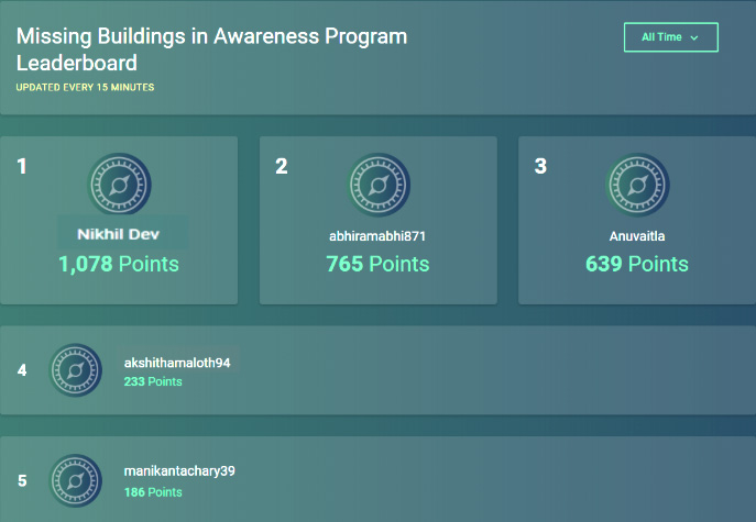
- Acknowledged the top 5 contributors and participants
RMSI has also created an authentic health facility database in India, by providing accessible data of accurate health care information and carrying out ground-truthing through sourcing, collecting, collating and updating the same in OSM. This database was created using information from Open Government Data directories including hospitals, health facilities, blood banks, health centers and health clinics in Telangana. The information was updated in OSM for the use of the general public and the humanitarian causes in India through OpenStreetMap.
During the program, volunteers from RMSI,
- Highlighted the importance of MAPS and GIS
- Focused on the prominence of OpenStreetMap in disaster management
- Conducted practical training on OSM iD editor
- Organised confidence building and morale-boosting activities
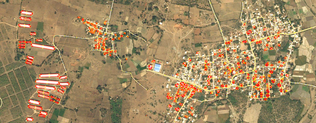
- Built a MapRoulette project for capturing the roads and buildings during the event
The participating students contributed roads and buildings coordinates in the iD Editor using the MapRoulette challenges. Nearly 5000 objects including roads and buildings were created during the Mappy Hours.
- Missing buildings identified during the awareness program: https://maproulette.org/browse/challenges/11588
- Connected the villages and towns – Srikakulam AP India: https://maproulette.org/browse/challenges/8929
RMSI HR team also supported the program actively by encouraging and motivating students in building their self-confidence and boosting their morale. They conducted fun games and activities for a comfortable learning. The team:
- Motivated the students by bringing up their talents in co-curricular activities
- Distributed snacks as a complimentary token, and
- Held a cake cutting ceremony for making the program and learning a memorable one!
Acknowledgments
The program aimed to enrich OpenStreetMap awareness and register students to sign up for it. It also helped RMSI in evaluating and validating its practices by assessing the quality information and data from the queries and projects by contributing students. The top 5 students were awarded under different categories including out of the box, quality excellence, top performer, creative genius and tech whiz.
The program introduced students to the basic concepts of mapping and geography. The program sessions focused on teaching students how to collect, edit and contribute map data to OpenStreetMap. The session enabled them to observe correlations between the physical geography of the world and the lines on the map. They gained a greater appreciation for maps for them to able to contribute, change and use OSM in their own way. The chance to find errors and fix them on the spot created a sense of contribution and ownership in the OSM map project and community.
Students were introduced to a multi-cultural, global community that they can learn from, as well as contribute to. Since OSM is open to all, not just the map but its data too is available for RMSI to use, change and re-distribute for free.
This program provided the general public and local students with an overview of the current accessibility of OSM maps, increased public awareness about maps, and RMSI’s contribution to it.
Happy Mapping & Best Wishes for 2020!