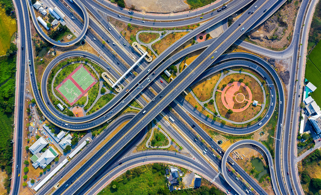
There has been tremendous growth in the construction of expressways and highways in the country to reach world-class standards, and India plans to build multiple new expressways by 2025.
Keeping mapping systems up-to-date and reliable with information on these ever-changing expressways and highways can be expensive. Due to limited budget, authoritative maps are usually not fully updated at regular intervals, presenting temporal, spatial, and completeness-related inaccuracies.
Map Intelligence with OpenStreetMap (OSM)
OpenStreetMap (OSM) has traditionally been recognized as a volunteer geographic information (VGI) project and one of the most successful. OSM is the world’s largest Volunteered Geographic Information (VGI) project, characterized by its map and an active community of millions of mappers who produce it.
VGI collects mapping information from individuals, usually volunteers, and stores the information in a database which is often freely available. The data is 100 percent crowdsourced and is available for everyone to use under an open-source database license.
Identifying the need to update high priority road networks
The road network is the most integral aspect of India, and high-priority roads(HBR) are among the most heavily used worldwide. They are the primary mode of the country’s functioning, connecting people, goods, and other raw materials.
While working on a national mapping project to improve road coverage in India, the RMSI OSM team witnessed that major road networks in India needed upgradation and modifications on OpenStreetMap (OSM) across the country.
Therefore, due to freely available and real-time data updates, OSM data’s significance in routing applications has grown significantly in the past few years.
High Priority Roads (HPR) in OSM
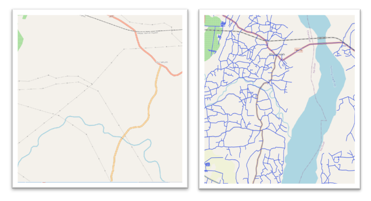
RMSI has completed the Enhancement of High Priority Roads for major cities throughout India. The high-priority roads, such as National Highways and State Highways, are reviewed in depth from a connectivity perspective after completing the AI road trace tasks for the specific area/location. According to the existing data, routes and refs are verified, and classification consistency and geometry modifications are maintained.
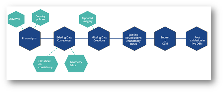
HPR Workflow Methodology:
The primary focus of updating HPR is to improve road connectivity and consistency from the secondary and above classification hierarchy, which plays a major role in the road network within the state/country. In addition, ‘references’ and ‘relations’ are constantly maintained.
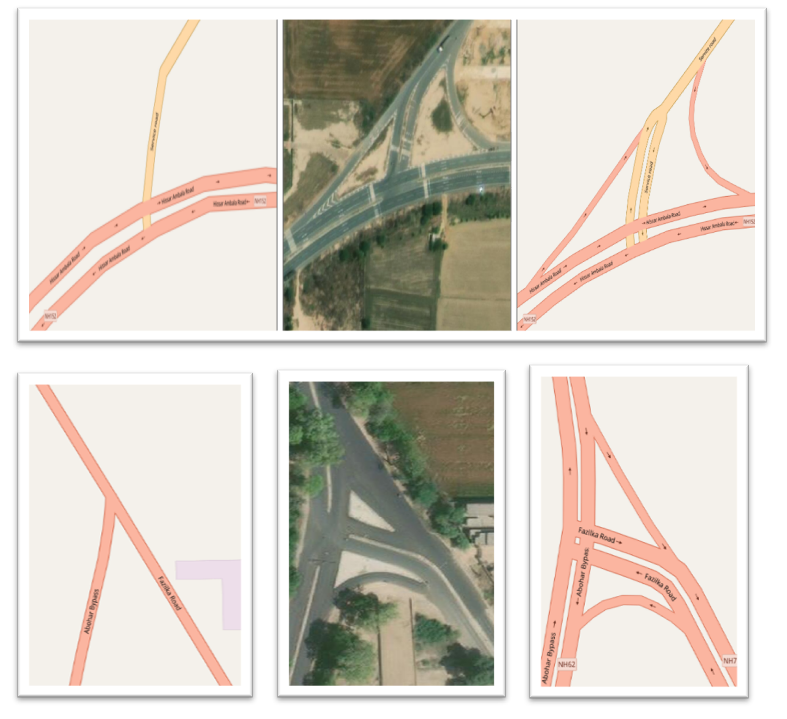
Ref in OSM INDIA
Ref tags are unique identifiers denoting the route number of a highway and are often enclosed on a highway shield. The ref values differ from country to country.
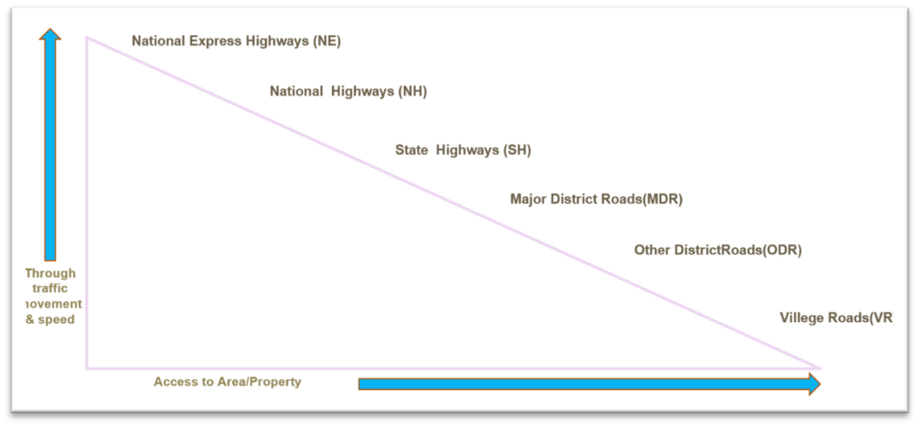
India Ref hierarchy:
RMSI OSM HPR Data Enhancements & Maintenance
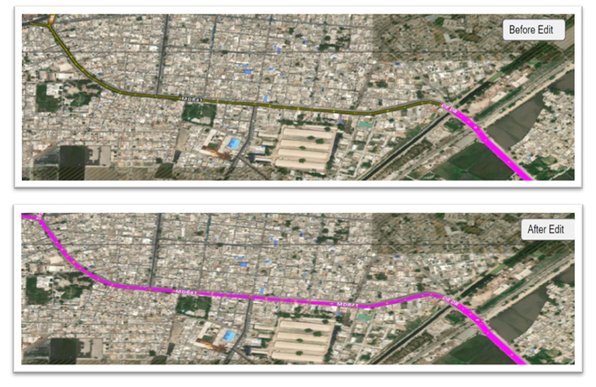
Since consistency plays a major role in the HPR Network, RMSI continuously monitors data vandalism and performs consistency checks, including under-construction highways, as part of the ongoing maintenance activity.
The team ensures data is consistent and updated in terms of geometry connectivity along with ref and relations. Apart from these, we check for the construction status of the road networks. Also, in cases where the construction is completed, the team removes the existing construction attribute and opens the road for access.
Use Cases:
Example of Roads under construction
Captured under-construction highways with temporary construction tags and appropriate highway classifications
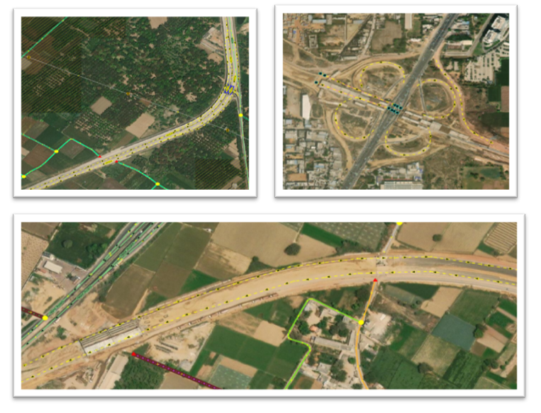
Example of Highway Junction Up gradations
RMSI OSM team identified many incorrect junctions without resource support, modified them as per the latest resources, and upgraded existing junctions as per the ground reality.
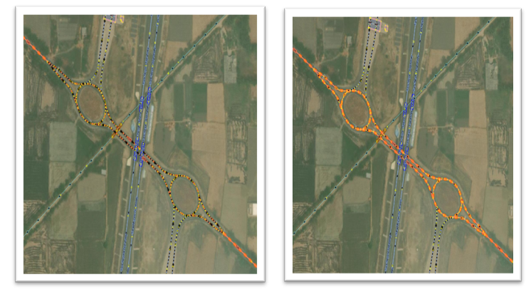
Example of Roundabout Enhancements & Up-Gradations:
Most of the roundabouts are missing in the existing high-priority road junctions; therefore, we added all the roundabouts and upgraded junctions as per the OSM guidelines.

Example of classification Inconsistency modifications/corrections:
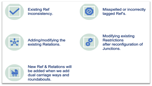
Example of Ref & Relations Enhancements:
Importance of Route Consistency in Building HPR Network Data –
A route or a variant usually belongs to a master covering directions, variant routes, and additional information on that route. It permits OSM to distinguish the two routes of a two-way trip.
Route planning is also applied as a part of location planning, analyzing catchment areas for different sites and calculating overall drive times to and from the site.
How is RMSI Enhancing High Priority Road (HPR) Network on OpenStreetMap (OSM) in India?
- From connectivity to an overall approach, we evaluate HPRs such as National Highways and State Highways. RMSI primarily focuses on classifying secondary and tertiary roads in India, which need upgradation to dual carriageways.
- RMSI has enhanced the High Priority Road data in 28 states with 317 cities and towns of India as part of the Artificial Intelligence (AI) Road Tracing Project. We have also identified and modified around 1, 74,415 km (about 108376.46 mi) of High Priority Roads (Tertiary, Secondary, Primary, Trunk, and Motorway) classifications.
Managing Precision & Quality Assurance all the way!
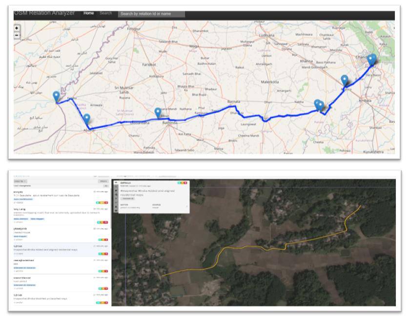
As the OSM is a live database, it is crucial to ensure the uploaded data is accurate with high precision. To achieve this high precision data, the RMSI team performs Quality checks on a minute level by using various tools like JOSM, Osmose, OSM Inspector, and various other customized overpass queries to ensure data is highly accurate along with these to check the consistency in relations; we use
RMSI is currently working to support expanded Information Management capacity within India. We aim to provide accessible data of accurate Road Network Information useful for those using OpenStreetMap.
RMSI aims to collaborate with the OpenStreetMap community to create high-priority road data, major missing POIs validated by trained mappers, and local OSM communities in India.
Hurdles on routes can lead to unnecessary delays and losses. Therefore, our team constantly works to improve & create an accurate route network across the country. In addition, we try to ensure that High Priority Road data is easily accessible to everyone using OpenStreetMap (OSM).
We are excited about our journey so far and are committed to improving the open data availability and usage in India. If you are interested in improving the high-priority road network, please get in touch with us at osm@rmsi.com.
Incase you missed our last blog on ‘Enhancing India’s High Priority Road Network in OpenStreetMap‘, please read it here