OpenStreetMap (OSM) is a community sourced and largest volunteered Geographic Information platform in the world. OSM is characterized by its dynamic map and the active community of the millions of mappers. These maps are available free of cost and are constantly improving each day.
Map Intelligence with OpenStreetMap (OSM):
There are various online mapping platforms that provide mapping services across the globe, and one such popular open-source platform is OSM, a free and openly editable map of the world. OSM is a web-based public platform that collects data describing the position of roads, rivers, towns, point of interests, etc. used to create maps.
While working on a national mapping project to improve road coverage in India, RMSI witnessed major road networks that needs up gradation and modification on OpenStreetMap (OSM).
Hence, RMSI initiated work towards enhancement and upgradation of High Priority Road (HPR) network in OSM data across the country (India) with the help of latest available imagery.
At RMSI, we are committed to addressing global issues of human habitation, security & safety connected with food, calamities, use of natural resources. While assessing solutions to the above major road challenges, our mapping experts noticed that a lot of priority roads didn’t even exist on most of the maps and there is a need to create and modify the road network as per updated imageries in OSM.
We believe strongly that the solution to most problems starts with getting the right data.
In our previous two blogs, Spreading Awareness About Mapping on OSM, a Free and Openly Editable Map of the World we highlighted about a workshop conducted by RMSI on OSM (OpenStreetMap)awareness and Enhancing India’s Health Facility Database in OpenStreetMap. Our latest blog focuses on RMSI’s expertise and knowledge implementation of the existing High Priority Road (HPR) Network in India.
High Priority Roads (HPR) in OSM
Any road, route, way, or thoroughfare on land connecting one location to another, paved or otherwise, improved to allow travel by some conveyance is a highway in OSM. Having based on the real-time features, these highways are classified under different categories, considering their importance in road navigation.
High Priority Roads
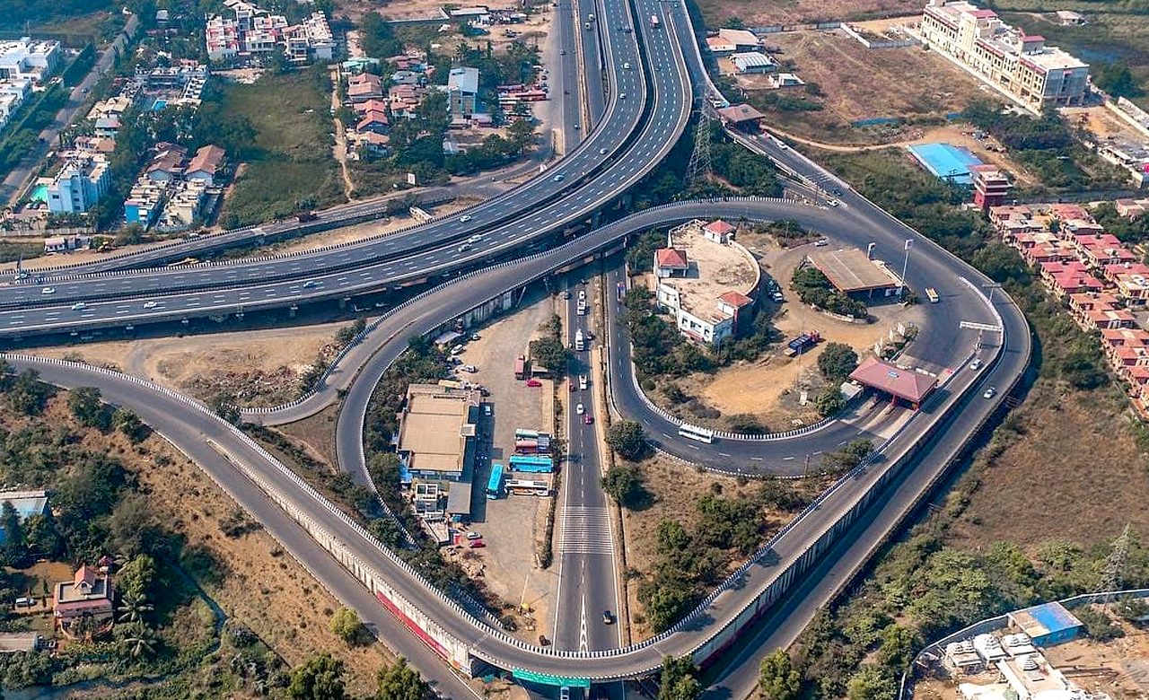
High Priority Roads (HPR) are the highest tier of road classification which establishes connectivity from one city to another city or a state to another, accessed by majority of people and thus, form a logical road network connectivity across the country.
India has the second-largest road network in the world at about 62.16 lakh km. The National Highways and Expressways measure 1,36,440 km and State Highways measure 1,76,818 km and other roads measure 59,02,539 km as of FY 2020-21.
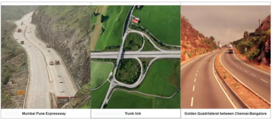
Indian High Priority Roads are categorized into four different types, such as:
- National Express Ways
- National Highways
- State Highways
- MDR Highways
What are the major challenges in existing High Priority Road (HPR) Network in India?
- Inconsistency in reference and relations on HPRs which needs constant upgradation and route correction
- Essential roads within the country, such as, National Highways and State Highways need to be upgraded as per the recent ground truth to form a consistent road network
To resolve the key challenges in the existing HPR data, RMSI is working on enhancement of High Priority Roads (HPR) across the nation. We evaluate HPRs such as National Highways and State Highways, from connectivity point to view after tracing tasks for a specific area or location.
Key Benefits of HPR’s
Majority of traffic flow is on high priority roads (HPR) due to trade, inter transportation, etc. Therefore, the significance of OSM data in routing applications is growing significantly past few years, due to freely available and real-time data updates.
If a road is not physically connected within the road network data, it impacts the correct routing for the passenger. Hence, by improving the HPR’s, RMSI is providing effective maps to the users and ease the navigation process.
Importance of Route Consistency in Building HPR Network Data
A route or a variant belongs to a master road including directions, variant routes and additional information on that route. In OSM, with the help of particular route types we enhance the navigation accuracy.
Route consistency will impact on:
How RMSI is Enhancing High Priority Road (HPR) Network on OSM in India?
- RMSI has enhanced the High Priority Road data in 13 states with 82 cities and towns of India as part of Artificial Intelligence (AI) Road Tracing Project. We have also identified and modified around 54,194 kms of High Priority Road (Tertiary, Secondary, Primary, Trunk and Motorway) classifications
- We identify HPRs such as National Highways and State Highways, from connectivity point to view mostly focusing on classification of secondary and tertiary roads that needs to be upgraded into dual carriageways
High Priority Road (HPR) Workflow
RMSI improved the workflow of HPR Network with various resources in reference with the latest and updated imagery. Secondary resources such as Mapillary and Probes were used as the primary tool for editing the HPR’s. We also used Aerial Imagery, Public GPX & GPS traces, OSM Country wiki, and Country Reference Values.
RMSI’s Solution for HPR Enhancement
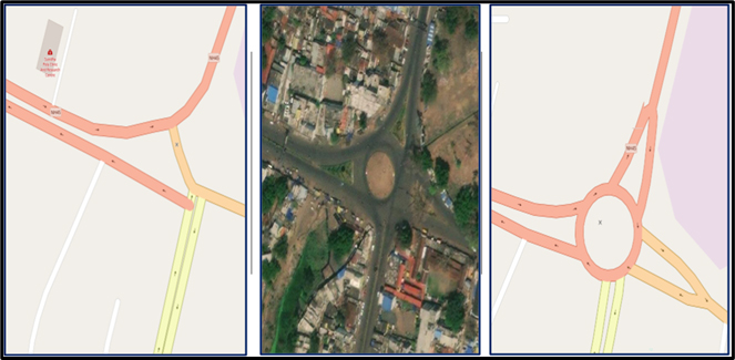
1. Roundabout Up gradation: In India’s OSM data, majority of roundabouts’ information needs to be upgraded according to the latest imagery data.
RMSI worked on upgrading the latest roundabout data which was missing in the existing HPR network that helps in achieving consistency of the route data.
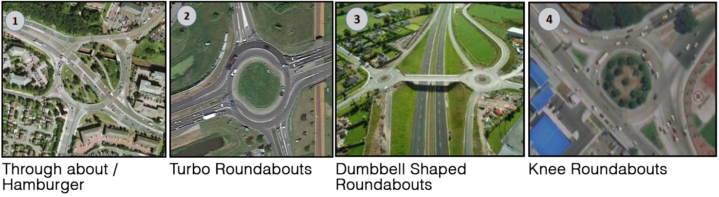
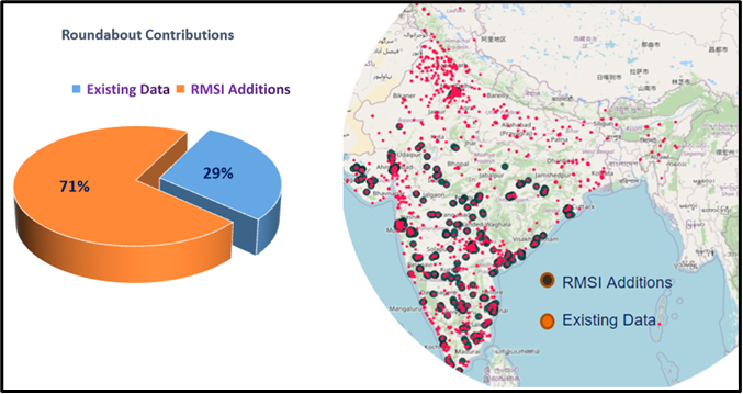
2. Data Contributions: RMSI contributed around 29% of new roundabouts across the country in addition to the existing roundabout modifications.
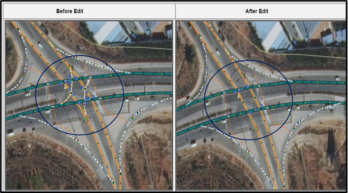
3. Geometry Enhancements in Bridges/Culverts Data:
In the image below, where existing HPR roads are not updated as per the latest image, we upgraded the junction and added missing dual carriage ways.
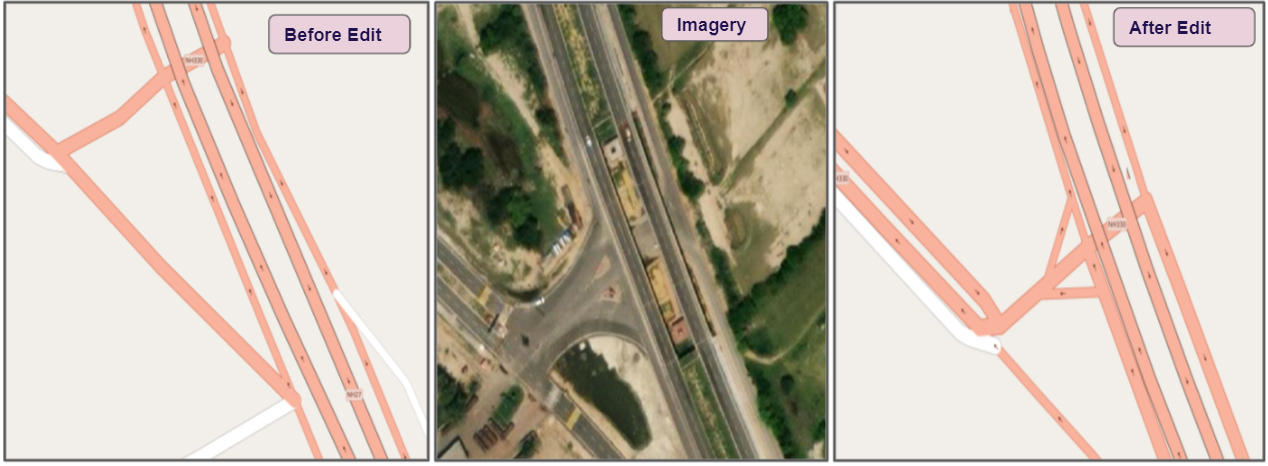
Various geometry edits that were done as part of the process:
- Linear Geometry Modifications
- Dual Carriage Road Upgradation
- Assigning Direction Restrictions
- Upgradation of Road Junctions as per Ground Truth.
- Establishing Missing Road Connections
4. Existing Data Corrections: There were additional roads that were present in the existing data but not built physically on grounds. RMSI worked towards updation of the accurate road data as per the latest resource imagery.
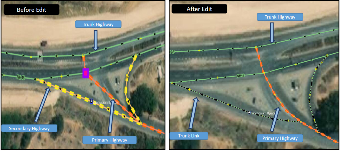
5. Classification Data Enhancements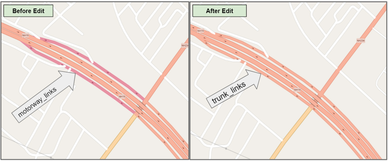
RMSI reclassified the road network as per OSM classification tagging guidelines and rectified the incorrect existing road classification of National Highway by identifying the classification gaps and inconsistency in the data.
6. Classification Inconsistency
In the existing HPR data, classification hierarchy is followed while modeling the data, therefore, we upgraded the road classification as per the OSM guidelines.
7. Additional Enhancements and Support
Addition to the necessary geometry improvements and classification changes, RMSI improved features for consistent road navigation with the following below:
- Modifying Ref & Relation inconsistencies
- Modifying the relations while editing complex junctions or highways which have existing relations corrections
- Adding missing ref tags to the newly added highways with support evidence
Use Case of Reference & Relation Enhancements
Example: RMSI identified many missing Road Network features in Hyderabad ORR existing relation, and added missing objects to the existing relation.

RMSI’s Role in Data Maintenance and Upgradation
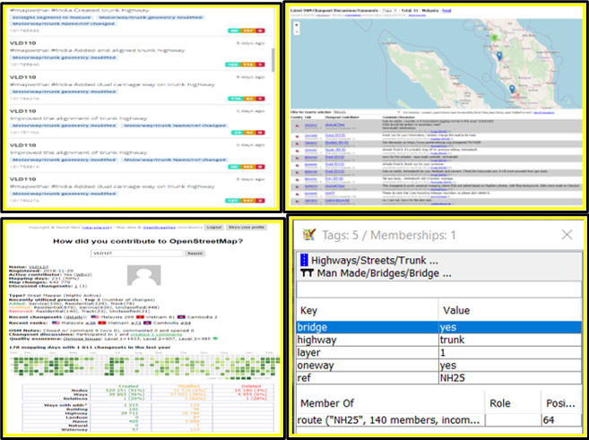
Since OSM is an opensource platform, there are chances of unintentional data vandalism by any new users, hence, there is a need to monitor the data and make the necessary changes when required. RMSI frequently use various tools to monitor the data and make the necessary corrections.
Utilizing error detecting tools, we examine the OSM High priority Road data for potential errors, inaccuracy or sparsely mapped places. We ignore false positive cases to maintain the real time data as per ground truth.
Since consistency plays a major role in terms of HPR Network, we check for data vandalism and ensure data is consistent and updated in terms of geometry connectivity along with ref and relations. Apart from these we look for construction status of the road networks. Also, in cases where the construction is completed, we remove the existing construction attributes and open the road for access.
- Validation Checks
- Suspicious Tags
Acknowledgment
RMSI is currently working to support expanded Information Management capacity within India. We aim to provide accessible data of accurate Road Network Information useful for those using OpenStreetMap.
RMSI’s goal is to collaborate with the OpenStreetMap community to create quality high priority road data, validated by trained mappers and local OSM communities in India.
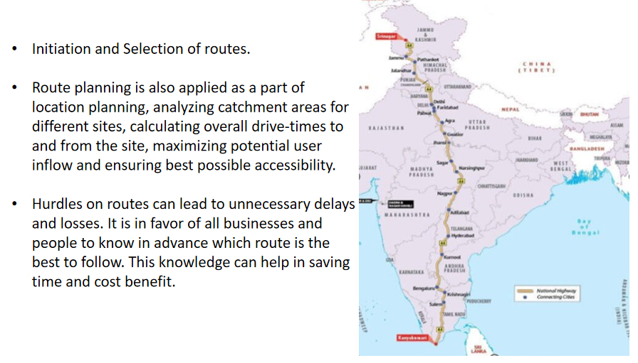
Hurdles on routes can lead to unnecessary delays and losses, therefore, our team constantly works to improve & create an accurate route network across the country. Core to the above goal, is also ensuring that High Priority Road data is easily accessible to everyone using OpenStreetMap (OSM).
If you are interested in our progress, please keep watching the periodical updates on our import wiki. If you are interested in improving the high priority road network, please contact us at osm@rmsi.com so that we can share maproulette for your region.
Happy Mapping!