Why we need real time flood forecasting ?
Flood is considered to be one of the most recurring and frequent disasters in the world. In India alone, each year, almost 2,000 people loose their lives and substantial economic losses are incurred. Recent floods events such as the Uttarakhand Flood – 2013, Jammu & Kashmir Flood – 2014, and Chennai Flood – 2015 are typical examples where huge losses of property and human lives have been recorded.
Flood forecasts are critical to emergency response programs to limit property damage and avoid loss of lives.
Existing flood forecasting practices and their short comings
The current flood forecasting systems in most parts of India are manual and are based on data from CWC’s discharge gauge stations located along the rivers and their tributaries in the country. But these flood forecasting practices have various limitations. The current forecasts are based on gauge-to-gauge relationships and have a short lead-time of only 8 to 12 hours prior to an event. They do not consider embankment breaches or inflows between two stations. Furthermore, they don’t have information about water surface profiles necessary for embankment safety and also do not consider other parameters for flood management such as area of submergence, depth and duration of flooding etc. Finally, they also do not have any mechanism for flood warning dissemination, public alerts, institutions and communities.
An innovative solution to forecast floods in real time
RMSI developed a flood forecasting system using open source based HEC family model – Hydrologic Engineering Center’s Real Time Simulation Model (HECRTS – www.hec.usace.army.mil/software/hec-rts/)
This flood forecasting system utilizes open-source web GIS libraries to disseminate flood warnings through the web. It is a state-of-the-art system offering real time flood forecasting and is based on the global best practices in flood management. The system offers forecasts as early as 3 days prior to the occurrence on an event, hence, enabling substantial increase in the lead time for evacuation planning.
How this system works
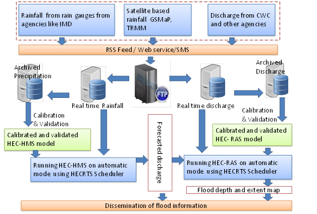
The system fetches the forecasted and real-time precipitation data through FTP protocol. This data is converted into HECDSS format, which is the native format for HECRTS Model. The HECRTS system runs through a scheduler at regular intervals. The tasks run through scheduler include:
- Processing precipitation data using MFP module of HECRTS
- Running hydrological model – HECHMS – which converts rainfall into runoff/discharge
- Running hydraulic model – HECRAS – to generate flood inundation and flood extent maps
Dissemination of Flood warning
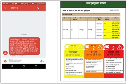
RMSI’s flood forecasting system issues flood forecasts to emergency management agencies and the public through SMS, e-mails and web, informing them on key parameters including water levels, flood depth and providing flood extent maps. The system regularly updates these forecasts as and when new observations are made on rainfall and as more recent rainfall forecasts become available.
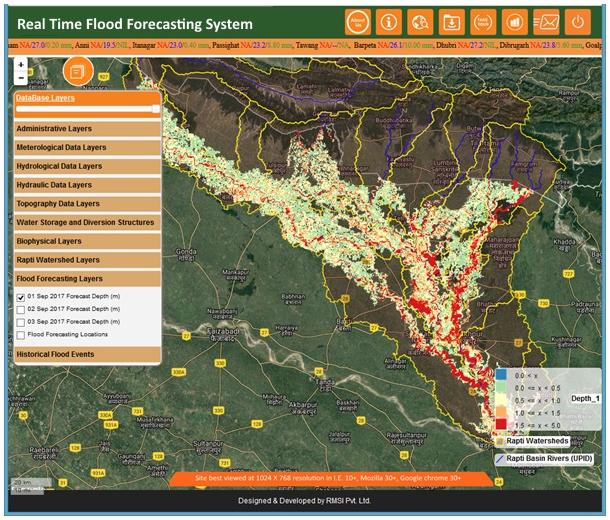
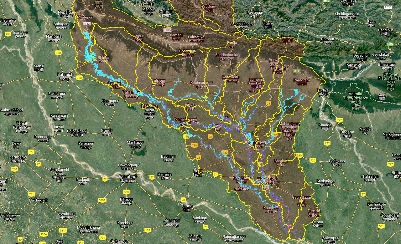
Real Time Flood Forecasting
The flood forecasting system overlays inundation maps (of forecasted flood) for next three days over an administrative boundary map at village-level so that the anticipated flood depth at any particular village can be evaluated.
They are completely automated with no requirements of manual intervention. They utilize open source flood models and open source GIS libraries hence are the most economical solution for clients.
Conclusion
Considering the fact that flood is one of the most rampant hazards globally, it is crucial to innovate and implement such advance forecasting systems to enable better disaster mitigation, hence, minimizing economic and human life losses.