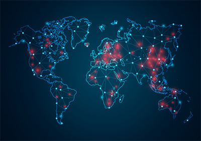
From tracing of contacts to creating buffer zones around COVID-19 clusters, the world is using location intelligence and mapping to fight this pandemic. At least since the 1850 cholera outbreak in London, maps and location-tracking technology have been used as a critical mechanism to tackle and access diseases related information. The world is currently re-looking at how mapping the disease data through geographic information systems (GIS) can help the authorities and policymakers during outbreaks.
 GIS is a system designed to capture and analyze data using spatial information and trends. With reference to disease observation and monitoring, it integrates data such as the area of outbreak, health of the population, and available infrastructure in the area to identify the population at risk. In recent years, GIS has been used to tackle and study many communicable and non-communicable diseases.
Location intelligence provides a valuable lens for COVID-19 response – identifying and exploring the dynamic connections between humans, their well-being, health, and the changing physical and social environments around them.
How Location and Spatial Intelligence is Playing a Key Role in Tackling the COVID-19 Pandemic
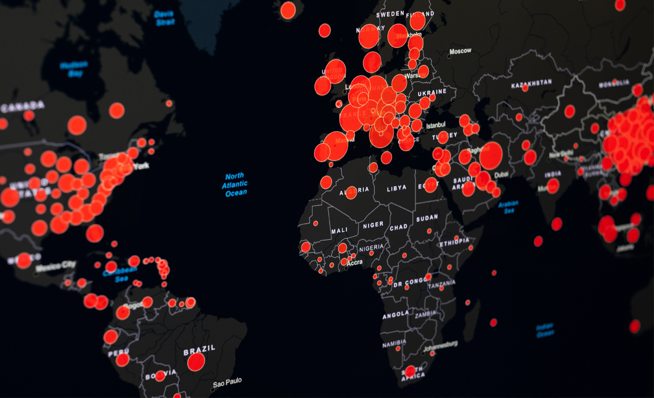
The internet is crashing with people poring over maps and graphs, looking for more and more information about the spread of and trends in the viral outbreak of the coronavirus. Hundreds of individuals and organizations have created and set up live dashboards since the outbreak happened in December 2019. These dashboards typically combine graphs and maps and draw their data from a wide range of information sources.
 The most widely known global dashboard is from Johns Hopkins University, based in Maryland in the US.
While these dashboards are an important component for creating and following a health and safety strategy to monitor and communicate about coronavirus, understanding how the outbreak has originated and spread from its origin and continues to move through the population is immensely important.
Here are 6 ways that location intelligence is helping the authorities manage and control the outbreak:
Contact tracing | Movement | Mapping vulnerable population | Air quality monitoring | Standard LI applications | Mapping the recovery
Maps and spatial intelligence holds a key role to play in understanding, planning to track, and resolving the Covid-19 outbreak. Real-time information, open data sharing, web-based tools & techniques, and interoperability are the key drivers to bring the outbreak under control and learn the patterns for the future. This will help us to understand and ensure that any outbreaks in the coming future are dealt with much more efficiency, preparedness, affectivity, and with a lower cost to life ensuring reduced economic and social impact.
 Multiple models are providing up-to-date estimates of how many people will have to be hospitalized, and maps help explore hospital capacity and impacts on people.
Scientific, statistical models and maps are helping the world in exploring COVID-19 surges and the capacity to help the government and people prepare. Some of the key facts are highlighted below:
- Mathematical modeling combined with location and spatial analytics is helping to calculate and present COVID-19 forecasts
- Investigators are using GIS to determine who an infected person has come in contact with
- Policymakers are using GIS to evaluate available healthcare facilities and increase their capacity to multi-folds
- Policymakers are also using these models and smart maps to examine the impact of their decisions
- Epidemiologists are monitoring the spread of coronavirus through time and space to implement surveillance, control, and preventive measures
- GIS is helping to explore implications of each forecast, answering location questions to guide response and recovery
Let’s further understand the importance of maps in the times of global pandemic crisis, how 21st century GIS technologies are supporting the global fight against outbreaks and epidemics and how geographical mapping is helping India in its fight against COVID-19
Maps and Apps Helping to Monitor COVID-19 Spread in India
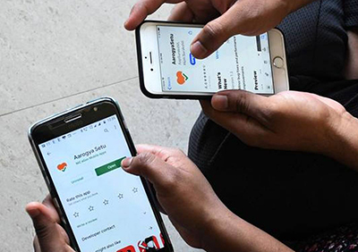 Along with the emergency helplines and lockdowns, India is using the Indian Telegraph Act to get information from telecom giants in tracking COVID-19 cases across the country. Many startups have shown support by building various dashboards and web-based applications that can track how close you’ve come to infected individuals or disease hotspots. All these applications use geofencing techniques to track infected individuals.
Here are some of the leading Indian apps and dashboards:
- Aarogya Setu
- COVA Punjab
- COVID-19 Quarantine Monitoring App – Tamil Nadu
- Noida Authority Apurti Suvidha App
- Locale.AI
- Brihanmumbai Municipal Corporation (BMC) GIS Map
- Esri’s India Dashboard
Information and analysis from the above dashboards and maps will help the government and people in reallocating resources and people effectively in the effort to contain the COVID-19 outbreak and reduce the mortality rate.
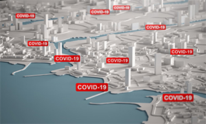
The Government of India (GOI) has also come out with a plan based on a cluster containment strategy where they will contain the disease through geographic quarantine. Therefore, location intelligence would play a crucial role here, as the government is identifying cluster areas, their buffer zones, and the area of operation that requires active monitoring and surveillance.
As highlighted in our previous blog, here some of these best maps for tracking coronavirus global updates LIVE
Various organizations in the world have come up with interactive maps providing live and most accurate information given the situational data on Covid-19. Some of the most accurate and top maps are:
- WHO Situation Dashboard
- The Esri Story Maps
- Microsoft Binge COVID-19 Tracker
- CrowdTangle – Covid-19 live display hub
 How India is Strategizing Response through Locational Intelligence in Cities during COVID -19
India is faring well and being appreciated for its early initiatives to control COVID-19 pandemic. India, a country with a population of 1.3 billion, has been able to contain and manage cases of COVID-19 to about 33,050, much below the global incidence rate, with minor community-based infection due to well-executed strategies, plans and pre-emptive preventive measures by the government.
“The government took swift action to put in a place a robust and comprehensive system of screening, surveillance and quarantine as part of its dynamic response to the public health crisis right from the beginning.”
India is also leveraging GIS technology for devising country-wide strategies to safeguard the people and economy. The ongoing coronavirus pandemic has raised several questions around the issue of housing and cities. In an almost global lockdown, we are forced to the corner to think about how we plan our cities, our neighbourhoods, the resilience of infrastructure to these risks, vulnerability mapping, preventive response, predictive analytics, and its effectiveness to avert this pandemic.
With these imprints and a vision of housing people, not diseases, we must explore further how big data, data science, analytics, and location and spatial visualizations are important for cities.
Preventive or reactive responses | Predictive analytics | Exit strategy | Mapping vulnerabilities | Crisis imprints
Combining Maps with Future Technologies
 AI can play a huge role in predicting and analysing a pandemic and also stalling or minimizing its spread. Not just maps, technology is playing a key role in tackling this pandemic at a larger level. Use of key Artificial Intelligence (AI) and Machine Learning (ML) technologies is helping in fighting the coronavirus through applications including population screening, notifications of when to seek medical help, and tracking how the infection spreads. While the Artificial Intelligence (AI) experts and community is working intensively on creating and delivering applications that can help to contain the virus, AI systems are still at a nascent stage and it will take some time before the results of these AI applications are visible.
Across the world, maps are combined with technologies such as artificial intelligence, machine learning, big data, IOT, etc. to protect people and get society back up and running from such pandemics. Use of these maps on smart devices with enabled Bluetooth support and technology-driven apps are helping the world fight this situation.
And therefore, maps continue to be the mainstream in supporting the world and they will play a huge role in keeping us safer and healthier.
Stay tuned for more interesting Covid19 related blogs!