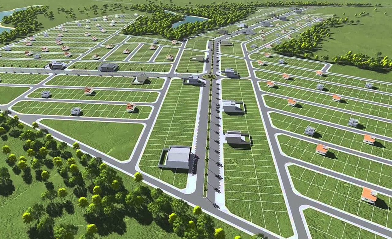
Access to land and land rights is the topic of focus not only for the World Bank and the UN but also for most governments across the globe. Efficient management of land tenure security and land rights of the common man is the gateway to the prosperity of a nation. A comprehensive land parcel database is essential to formalize land ownership and define the rights, restrictions, and responsibilities (RRR) of a piece of the land owner.
Several countries follow different systems of records to store spatial and non-spatial data related to land. ‘Torrents system’ of recordation is one of the most common methods followed by colonial countries. This system was devised by Sir Robert Richard Torrens (1814–1884), an Irish land reformer. Torrens designed a land registration and transfer system, and according to this system, the state creates and maintains a complete register of land holdings (fabric) which is conclusive evidence. This conclusive evidence is for the property and its ownership. The person recorded on the register is the owner of RRR. Governments across many countries are struggling hard to achieve this State wherein every bit of a state’s land is mapped as a fabric.
Over the years, many software like CAD and GIS have been used for mapping and maintaining land parcel information. Most of the land registry offices maintain hard copy registers in which all the land parcel details, ownership rights, development restrictions, etc., are recorded.
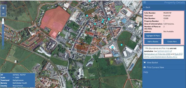
The figure shown below is an example from the Republic of Ireland that shows a freehold property measuring 5.25 hectares. This is a conclusive title for this property that has a folio numbered (RN39574F). This folio contains the description of the property, ownership details, rights and responsibilities, and encumbrances, if any, besides other details of the property.
Land parcels are of many types; some are parcels on the ground, and some are parcels in the air (also called strata parcels). Strata parcels have Strata title, a form of ownership devised for multi-level apartment blocks and horizontal subdivisions with shared areas. The word “strata” refers to apartments being on different levels.
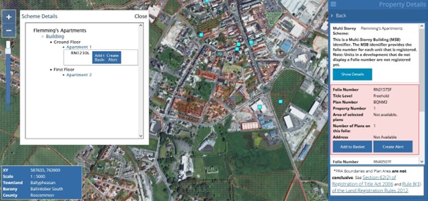
The figure below refers to an apartment complex with 2 floors (seen only as attributes in the ‘Schema details’ on the left-hand side window). Most of the land registration offices only have information at this level, wherein a 3D representation of the actual apartment block is unavailable. This is because of the lack of a data model to store the 3D data pertaining to multi-storied buildings (MSBs).
The modern cadastral parcel mapping and management systems are designed to store the multi-storied buildings and the units on each floor level along with the common areas (like corridors, parking, gym, swimming pools, etc.). The property registration authorities or the cadastral agencies usually do not require a high level of interior details of the buildings. Identifying the building on a cadastral parcel, a floor in a multi-story building (MSB), and a strata parcel (unit) on each floor should be possible.
Such 3D strata parcel data for an MSB is created from the floor plan of the building (either from the planning drawing or from the as-built drawing). These floor plans are georeferenced and extruded to their design height to obtain a proper georeferenced 3D model of the building.
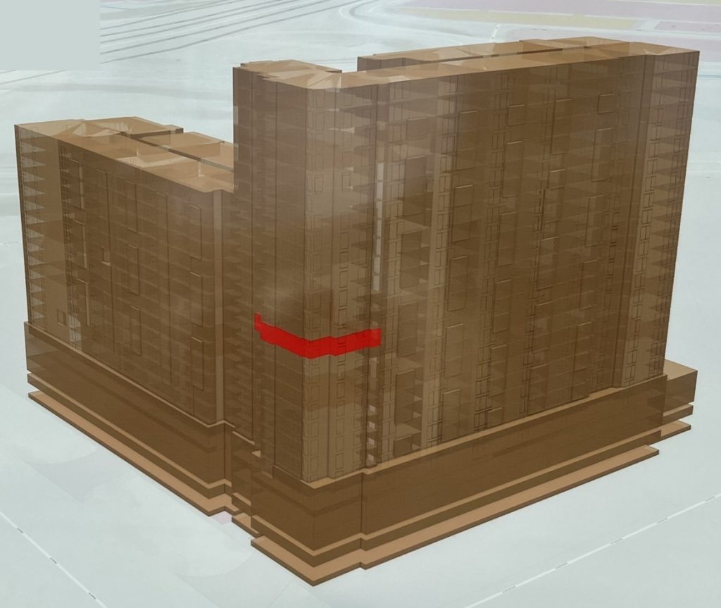
The figure shown below is a 3D model of a multi-story building with each unit (strata parcel) identifiable. This makes it easy for the registration department staff and the property owner to visualize the strata parcel in a 3D environment. Increasingly, the modernization of land registry programs across the globe targets achieving this maturity level.
While there are many open source and proprietary software tools to create, maintain and manage cadastral parcel information, this blog focuses on ‘Esri’s ArcGIS Pro Parcel Fabric tool’ which is gaining popularity among the organizations already using Esri tools and organizations aspiring to move into Esri’s environment for parcel management. Esri has also made this product compatible with 2D, 3D, and BIM editing and integration capabilities. Esri introduced this parcel fabric information model in ArcMap, which has been upgraded to ArcGIS Pro.
The advantage of parcel fabric over a conventional cadastral parcel mapping is that in the conventional parcel mapping, all the data necessary for analysis may not be part of the same environment and may have anomalies such as:
- Inconsistent structure
- Without standardized attributes
- Line strings and arcs not properly denoted
- Issues in inversing and populating coordinate geometry attributes
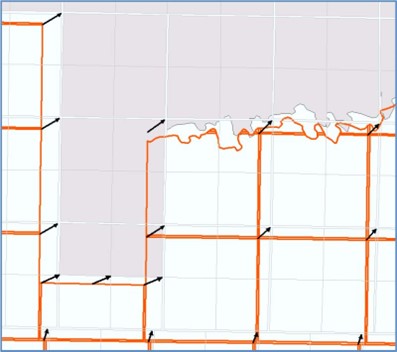
- Lack of spatially improving source data to edge match with adjacent datasets
- Absence of topological testing to ensure the cadastral fabric topology constraints are achieved
But with the parcel fabric, all these above-mentioned points are taken care of, making parcel mapping a holistic solution for cadastral organization’s needs. This parcel fabric is a controller dataset that controls feature classes and topology. Parcels are stored as parcel types (tax parcels, lots, revenue parcels, etc.), and each parcel type has its own polygons and lines.
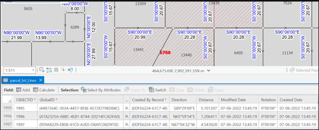
RMSI carried out a pilot work for one of our customers who had the cadastral parcel data in oracle. This data was taken into ArcGIS and then later to ArcGIS Prop Parcel Fabric. The figure below shows the land parcels organized as a normal geodatabase. There is no fabric of land created, and all different types of parcels are captured.
The migration from the geodatabase to parcel fabric was fairly an easy process. The same land data is captured as a fabric in this figure below, and all the various types of parcels are captured one above the other.
Some of the benefits of using parcel fabric for parcel mapping are
- Customers who have the parcel data as CAD files, shape files,s or geodatabase can easily migrate it to ArcGIS Pro parcel fabric.
- It is easy to maintain the land parcel fabric and integrate the new source datasets into it
- The parcel layers can be updated by using a repeatable process
- Advantage of having all the datasets necessary for decision-making all in a single fabric.
- Parcel fabric is a seamless extent of cadastral information for a complete city or a state
- It is easily sharable and scalable as it is within the Esri framework and suite of products.
RMSI, with its vast experience in land management solutions in Europe, the Middle East, Asia, and Australia, has a good understanding of the land registration process, land information systems, land taxation, land conveyancing, and parcel mapping, among other land-related aspects. RMSI has successfully designed, developed, and implemented many national land information systems for countries across the globe. Our continuous engagement with multi-lateral funding agencies like the world bank, Asian development bank, and African development bank to successfully deliver projects related to land management stands witness to our land management domain capabilities.
If you want to know more about our Parcel Fabric service offerings, write to us at info@rmsi.com.