
Last week, a colleague of mine forwarded the Gazette notification of National Geospatial Policy 2022 and asked me, “what benefit this new policy will bring” It was a sheer coincidence that same day, one of my college acquaintance, who is also a geographer, forwarded an interesting article published in the Frontline in 2021, on the ‘Survey Saga’ written by Mr. R. Ramachandran.
“Ramachandran has narrated how 200 years back, William Lambton and later George Everest completed the Great Indian Arc of the Meridan, which laid the foundation of the Geodetic Survey of India. The base on which the datum and projection systems were set for all geospatial processing of the country’s data.
William Lambton died while he was on this mission, and George Everest later completed the Survey Saga. Nevertheless, the efforts made by Lambton and Everest and their team were worthwhile as they laid the foundation for all mapping activities of the country. Ramachandran, in his article, says, “As a corollary, at the end of this massive and perilous exercise, which consumed “more lives than in most contemporary wars” and involved tonnes of calculations and equations more complex than any in the pre-computer age. It was conclusively proved in 1843, that the Himalayas constituted a mountain range higher than the Andes, until then believed to be the highest. It also established the height of the highest point on earth, now called Mount Everest.”
William Lambton was obsessed with precision & accuracy and was exceptional in mathematics. His best effort was to survey the country’s length and breadth. The Survey Saga explains the use of the theodolite, which weighed over half a tonne, requiring a dozen strong men to carry. The team constructed several towers 10-16 feet in height, of which many can still be seen as monuments in different parts of the country.
You may wonder about the relevance of Survey Saga and the new National Geospatial Policy 2022. My colleague’s question triggered me to look back into the evolution of the map policy of the country and share thoughts on “what benefits does the new policy bring in” and what we can achieve through this forward-looking policy initiative of the Government.
History of India’s Mapping policy and its evolution
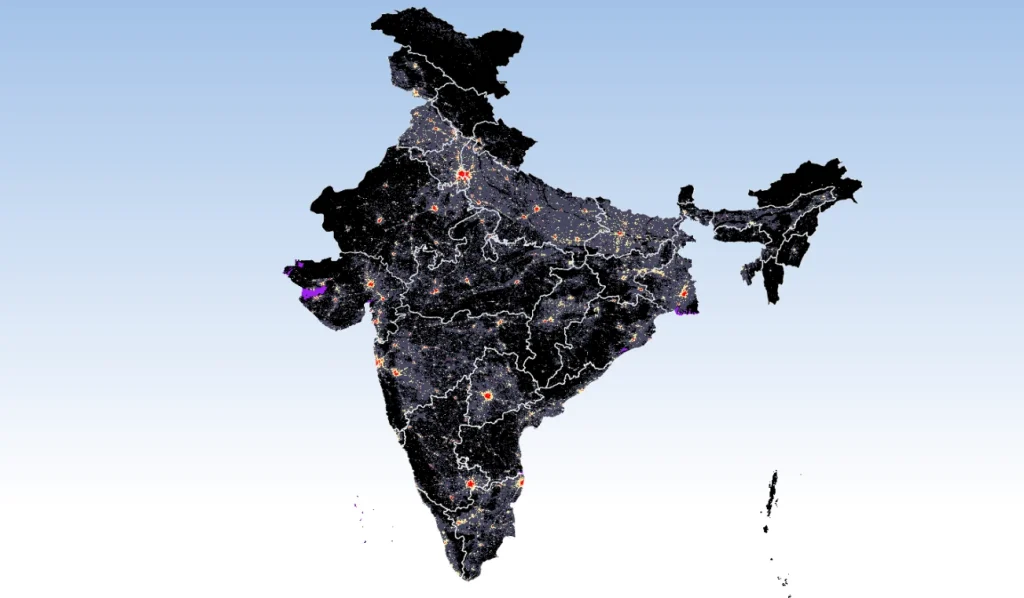
Due to its diversity and several other factors, India has an edge to prove its excellence in diverse fields – information technology, mapping, remote sensing, development planning, and disaster management. Our talented people have converted lots of challenges into opportunities and demonstrated solutions and tools tested in the best environment in the world. Furthermore, our traditional knowledge and inherited skills in astronomy and mathematics have helped India to be a great ancient contributor to geoscience and information technology.
India’s mapping policy dates back to the survey of the Great Indian Arc of the Meridian and was defined by the Britishers. The topographical mapping was carried out by establishing a survey company and later converted to ‘Survey of India.’ In India, land and territorial boundaries are considered a sign of power, and for that reason, till today, our map policy is ‘classified’ and has ‘restricted access’. However, the advent of technology has taken map and mapping science to much easier levels, with sophisticated instruments taking care of the fundamentals of the Great Trigonometrical Survey (GTS), which William Lambton took four decades to complete. Now we have the hand-held GPS, which uses the same fundamental of GTS, triangulating with satellites orbiting around the earth. The only difference is that these hand-held devices still use the GTS set by William Lambton as a reference point to ensure accuracy and standards with other surveyors.
The earlier map policy of the country classifies extensive information/maps and data related to space as ‘classified information’ for security reasons. With technological advancement, it is essential to review this map policy of India, and for the last three decades, practitioners and policymakers have been discussing these aspects. However, it took a while for India to publish such a forward-looking policy.
I can recall one instance 30 years ago, that connects to the evolution from the ‘map policy’ to the ‘new geospatial policy.’ At that time, the telecom sector in India was at its zenith, making the leap from landline to mobile technology. Several telecom players were working in parallel to establish their mobile towers. They wanted to optimize their respective towers, which essentially needed the terrain information of the city. Considering the potential density of users, the cities were targeted first. However, the fastest source of terrain information, – ‘topographic sheets’ or ‘open source SRTM data’, was not easily available then. As a coastal state, most of the areas of Kerala’s toposheet were restricted, so the access to terrain information to telecom players was limited. Some of the people I knew tried using their local knowledge and estimates to move ahead with the installation of the towers in different parts.
I am sure all of them wished for the terrain data (coarse resolution at least) of the major cities of Kerala on their desk to make Pan-Kerala planning (identification of location and budgeting) for installing towers. It probably might have cost them more that time without the terrain data, but the market demand still drove them to move with whatever information they had and set up an efficient network.

The geospatial policy 2022 has been drafted carefully with a future vision and has been conceptualized over time. The Indian government has taken similar but gradual steps in the map policy and remote sensing data policy in the last two decades (including the National Map Policy, 2005, remote sensing data policy 2011, guidelines on the acquisition and production of geospatial data and services 2021, Instructions for Publication of Maps by Government and Private Publishers, 2016 and Ministry of Defence guidelines on the restriction of sale, publication, and distribution of maps, issued in 2017).
Data open policy initiatives
Several national agencies and departments understand the need for easy access to data (spatial data in particular). They have taken steps within their capacity to enable open access to data. The private sector also has a significant role here; e.g., navigation maps such as Google Maps have been a catalyst for India to move towards this new spatial data policy.
Central Water Commission is one of the premier organizations that took the initiative of open access to a series of water resource data of India through India-WRIS. In addition to GSI, IMD also started providing public access to many data sets like climate data (more than 30 years of weather information) in the public domain, encouraging researchers and academicians to conduct extensive climate change research. Open access to data provides an impetus to developing scientific research. The National Remote Sensing Centre (NRSC) has launched ‘Bhuvan’ for public access and ‘National Disaster Management System (NDMS)’ for usage by government departments in all the states.
What benefits does the new policy provide?
The preamble statement of the new geospatial data policy 2022 highlights the sectors that will benefit from the policy. “Geospatial technology has applications in almost every domain of the economy ranging from agriculture to industries, development of urban or rural infrastructure, administration of land, economic activities of banking and finance, resources, mining, water, disaster management, social planning, delivery services, etc.” According to several private sector geospatial business leaders, the latest geospatial data policy will create many avenues and boost the economy.
Geospatial data is used in almost all development sectors, from government development planning to diverse marketing or online food delivery services. Geospatial data usage has diversified business avenues, making business operations easy and much more efficient. For example, the navigation tool in cab services efficiently uses geospatial data to allocate the nearest resource to the customer, optimizing the to-and-fro fuel cost of the vehicle to any destination. Additionally, the delivery service uses this spatial tool for effective delivery.
While the private sector will effectively utilize the new policy, the public sector must take steps to ensure proper implementation.
Let’s try to list down some apparent and new future benefits:
- First and foremost, the policy promotes easy access to data, avoiding duplication of the same data by different users. It saves a lot of money and time, which can be used for further developing the data or carrying out analytics.
- With the policy encouraging open access, the data force will automatically establish a standard of data accessible to diverse users. It includes quality standards (accuracy), projection standards, and metadata documentation.
- Access to high-resolution data can promote advancement in different development fields. For instance, almost all States vulnerable to floods are trying to develop early warning systems and use terrain models to develop flood inundation models. Some states, with additional funds, created high-resolution terrain models for the full/part of the river basin and used them for the flood model. However, these high-investment terrain models are developed for specific usage but can be used widely; if shared with the Government or the State’s central database. Unfortunately, the traditional data privacy policy also doesn’t allow the custodians to share the data with other users.
- The policy envisions having a terrain model for the whole country by 2034. The terrain data has a wide range of applications – urban planning, disaster management, landscape modeling, and other development sectors.
- Access to high-quality geospatial data will also open up avenues to new businesses of geoscience and any businesses that relate to space.
- This policy has already given a new impetus to the National Spatial Data Infrastructure (NSDI) and State Spatial Data Infrastructure (SSDI), which the government initiated a decade back. All the States were directed to develop a centralized database under this program which can be shared across departments and reused rather than different departments recreating the same data. The new policy gives more clarity and momentum to this initiative. Some States, like Kerala, launched SSDI in 2013, utilizing the data, but the usage was restricted to limited government departments.
An evolutionary roadmap
Over the last three decades, there have been constraints on access to spatial data, which were earlier in the form of complex copy maps. I am excited to see the new policy and its road map. I cannot wait till 2035 to see the transformation that can happen with this liberalized and forward-looking policy.
The policy document suggested a road map phased into three distinct stages. First, an enabled legal and institutional framework for data development and sharing by 2025, high-resolution terrain data by 2030, and high-resolution bathymetric data and subsurface infrastructure data by 2035. Considering the size of the country, this timeline and road map is very realistic, and it needs more than 10 years to achieve this. However, looking at the policy and its completion with a positive mindset, the State Governments can take the following proactive measures:
- Ensure all new spatial mapping is cataloged properly along with metadata, and the info of newly developed data is disbursed to the respective nodal agencies mentioned in Annexure III of the policy document
- Any development ongoing projects to generate spatial data, irrespective of government funds or external funds, should follow the data standards and consult the respective nodal agencies. These will help stitch these datasets together to make a national-level database later. It will also avoid duplication of efforts and money spent on the data development
- All spatial data developed should be pooled at the State level, and State agencies should coordinate with Central agencies to build the national database. In this line, DST has issued a note on the implementation of the “Interim Data Sharing Framework (IDSF)” in Aug 2022, which sets a mechanism for updating the database in SSDI.
- While some data generated can be accessed for free, there should be a pricing mechanism for the procurement of high-investment data like the terrain data
- There should be mandatory guidelines to explore the available existing data before any agency ventures into creating new spatial data
- Suppose the private sector wants to generate any spatial data for their business interest. In that case, there should be a provision of pooling this to a State resource through some procurement mechanism so that later this data can be utilized by other users as well.
How to leverage open data and data standards
It is essential to look at other international success models and leverage this to ensure that we get the optimum benefits of the new geospatial data policy.
Learnings from the Singapore SDI will be relevant here. Singapore, through NSDI, has increased the use of geospatial information and technology in its public and private sectors. Singapore’s SG-SPACE is a government-led initiative behind the implementation of NSDI. SG-SPACE is trying to utilize geospatial information for national-level decision-making, public security, cost-effective businesses, and building location awareness among citizens. Through its OneMap application, which has more than 50 maps and around 30 map services available free of cost for the public. Singapore also leverages geographic information using crowd-sourcing techniques. It will help locate the areas of interest at emergency operations, mark hot spots, etc.
Since the launch of SG-SPACE, the Singapore government has been trying to catalyze the use of spatial data within the public and private sectors. SG-SPACE also faces some difficulties, including a lack of coordination amongst the organizations and between different administrative levels leading to the duplicity of datasets.
Similar to OneMap, India should quickly initiate the Unified Geospatial Interface (UGI) mentioned in the Geospatial Data Policy, and data like boundary data should be available free of cost. For starting UGI, several steps need to be taken, and institutional arrangements are to be made:
- The pricing should be nominal considering multi-user protentional. It can be as minor as the print maps.
- There should be a proper referencing mechanism for source data to ensure authenticity. The metadata should document the author, vintage, and version.
- There should be a mechanism for auditing and certifying the data quality. If the user highlights data errors, they must be addressed and acknowledged, irrespective of who created the data. Google maps’ reporting mechanism is much simpler, and a similar approach needs to be taken. The data presently available in Bhuvan has some issues, and Government should institutionalize a mechanism for reporting errors. Users often have local knowledge and generated data at the local level, which will be superior to data developed at the Pan India level
- Development projects should ensure they use this data rather than recreating the same data. It will help using standard data across different users as well as saving money from recreating data
- There should be a mechanism for users to contribute to the database through a proper audit mechanism.
- The State and National Governments should take the lead in collating data from different sources into the national database. Gathi Shakti is one such initiative by GoI, making efforts in this direction focusing on infrastructure data. However, some States are just sharing data that is not relevant. It probably is because of the lack of clearly defined guidelines for data sharing.
RMSI, as a leading global geospatial service provider, is geared to work with the government for the New Geospatial Policy 2022, playing the defined role of the private collaborator. RMSI supports Open street maps, adding missing Points of Interest in OSM data across the country. RMSI also works in different national, state, and local administration domains. We support the government administration with diverse spatial databases and data models with a wide range of applications from the development sector to disaster management.