High definition (HD) maps, also known as precision maps, are highly accurate 3D dynamic maps that are shifting the landscape from traditional static maps to High Definition maps rapidly. With amazing precision at the centimeter level, HD maps have become a key technology in an industry that has seen astounding development in the past years – autonomous driving.
In this blog, I would like to share why HD maps have become so important for the autonomous driving industry, what are their advantages, as well as challenges, and how major players of the HD mapping industry are planning to overcome them.
 Autonomous Driving and HD Maps
The number one issue that exists ever since vehicles were invented, especially the modern car, is safety. With approximately 1.35 million people killed every year in road traffic around the world, road safety is a serious concern of every country.
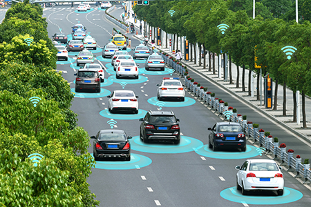
There is a growing need for new inventions that will increase the safety of drivers, passengers, and pedestrians. That’s one of the main outcome that is expected from autonomous cars.
The Contribution of HD Maps
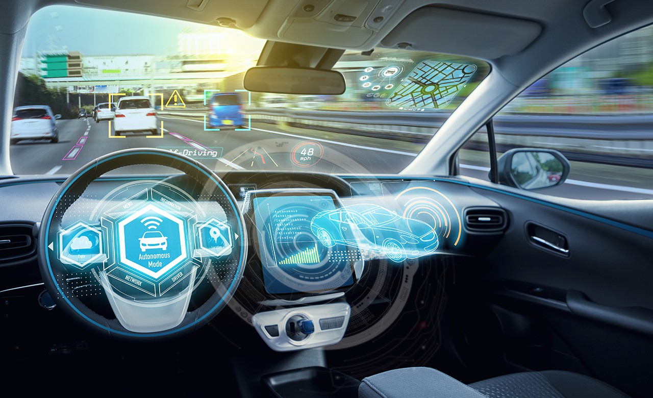
Autonomous driving technology relies on sensors and HD maps act as a verification system confirming what sensors are seeing.
The main advantage of HD maps is that they provide navigation details accurate to a sub-centimeter level, providing autonomous-driving technology what it requires the most – utmost precision. HD maps also offer real-time navigation cloud services to autonomous vehicles.
Furthermore, HD maps successfully address the localization problem, providing detailed and valuable information of the surrounding objects – traffic lanes, pedestrian crossings, curbs location and height, speed limits, etc. This way, they are improving the car’s field of view by accurately representing the environment, using all of this data into a “digital twin” which can be processed by algorithms and AI.
Key Challenges with HD Maps
Like with every new and innovative technology, there are certain challenges that HD maps are encountering and that need to be overcome so they would become widely used.
The High Costs
The greatest challenge is the high cost of developing and maintaining HD maps. Several complex factors go into this equation:
- Sourcing and collating data using LiDAR technology, cameras, location sensors (GPS), etc. (the price of a single data-collection vehicle is more than $1 million)
- Integrating AI Capabilities
- Incorporation of live data, etc.
However, the highest cost comes from the maintenance of HD maps. Inaccuracies of even a few meters are not acceptable for HD maps, so there is a constant need of maintaining the data at the highest accuracy.
What’s the Solution
The major players of the HD maps market, like TomTom, Google, HERE, etc., are focusing most of their efforts on internal research and development to find innovative and cost-effective ways of processing the obtained data using ML/AI apps, which would consequently reduce the costs.
Some of these innovative methods are fingerprint base maps, vector, and tile-based map formats, data-streaming from clouds, etc.
Also, partnerships with the aim of exchange of knowledge and mutual assistance between industries in the HD maps market (like automotive electronics suppliers, mapping tech start-ups, car manufacturers, etc.) can prove to be crucial for cost reduction.
Data Collection
Making HD maps requires mapping millions of kilometers of roads per year since the ultimate goal is to provide dynamic maps of every corner of the Earth.
The sheer amount of data comes to more than 105 times that of traditional navigation map that needs to be processed is unfathomable. One hour of drive time equals one TB of data.
So, what’s the Solution
Scaling the production pipeline with automation, by using deep learning and machine learning algorithms, and training AI models that are performing tasks much faster than humans.
Also, some HD mapping startup are turning to crowd source, where they encourage drivers to record videos and upload them to their databases in exchange for rewards.
Edge computing with 5G brings computation and data storage closer to where data is generated, deploying HD map server under “cloud-edge-end” mode will mitigate the high latency ensuring the reliability of the HD map service, and providing high-quality HD map service for autonomous vehicles instead of “cloud-end” mode.
 How RMSI Positions itself in this Environment?
As one of the global leaders in geospatial and engineering solutions, RMSI’s contribution to HD mapping is invaluable.
RMSI implements innovative solutions to tackle the above-mentioned challenges, such as the EdgeX annotation and labelling platform which processes translating 3D imagery, into a vectorized “digital twin” which can be processed by algorithms and AI for automatic extraction of objects (road lanes and boundaries, buildings, road and traffic signs, etc.).
By using semi-automated checks, RMSI builds and maintains complex, high-quality HD maps while maintaining low costs. It offers seamless integration with the client’s AI/ML tools, as well as its own, if necessary.